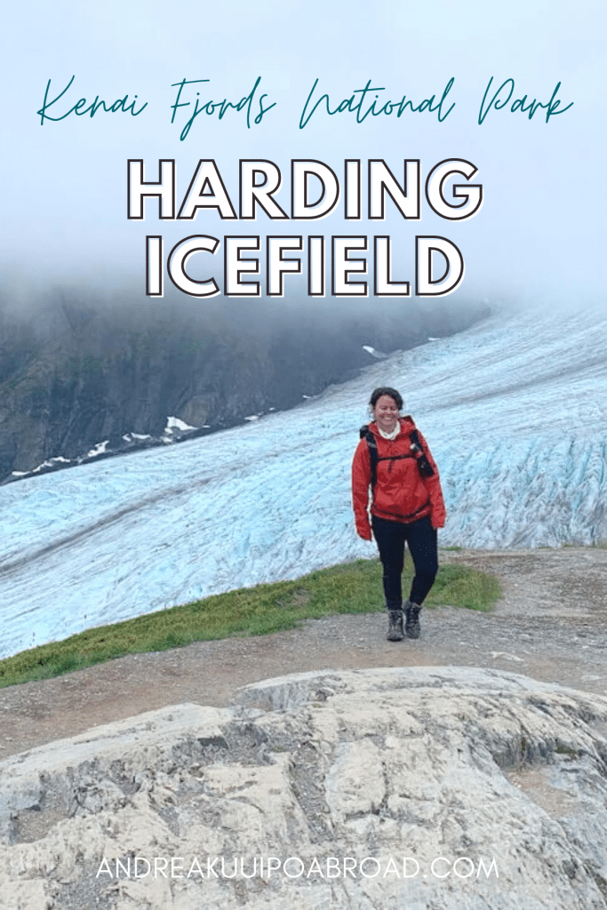
Harding Icefield Trail is one of the coolest hikes in Seward, Alaska. Even though the weather wasn’t the greatest when I hiked this trail, I was so excited to finally see it with my own eyes!
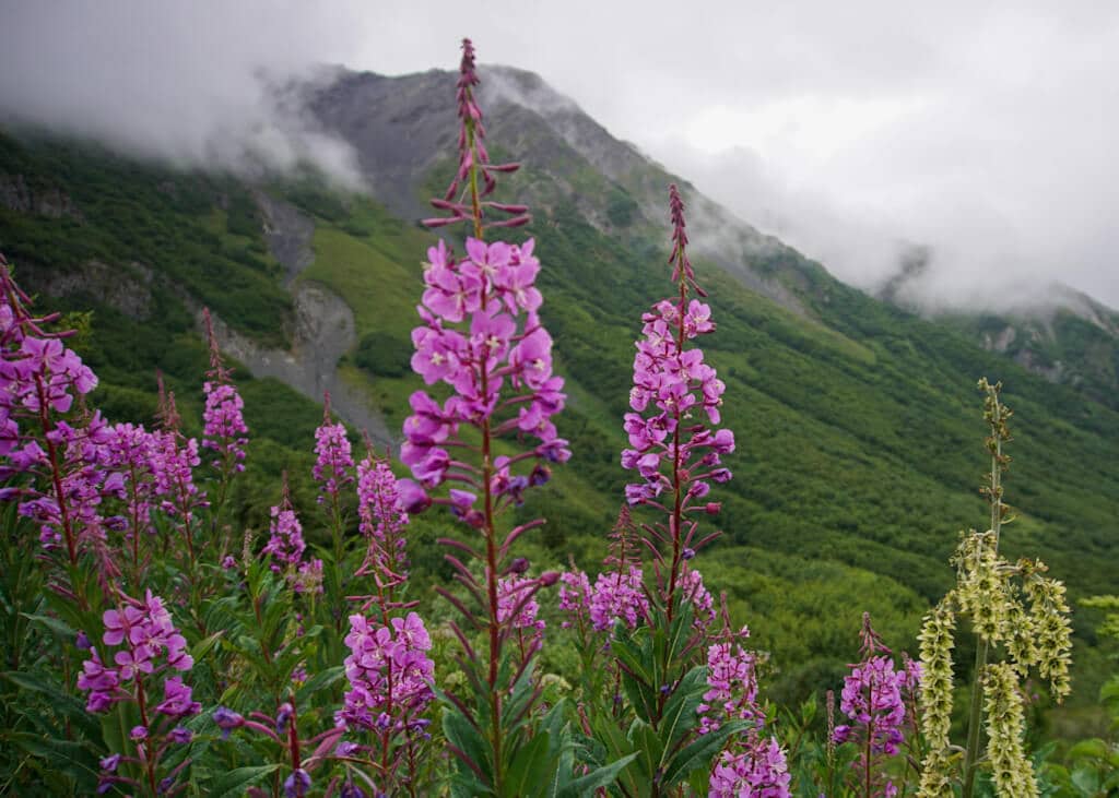
The hike takes you through the forest, across a meadow with beautiful wildflowers, up the tundra, and ends at a rocky overlook of the massive sheet of ice that is Harding Icefield.
The Harding Icefield Trail is best used from July to September, but it always comes down to snow conditions. The photos that I share in this post were taken during the month of July.
In this post, I’m going to share how to hike Harding Icefield Trail in Kenai Fjords National Park.
Harding Icefield Trail Summary
Traditional Land: Alutiiq (Sugpiaq) (Visit Native-Land.ca to identify whose land you live, work, and play on.)
Distance: 8.2 miles roundtrip
Time: 8 hours
Elevation Gain: 3,500 feet
Difficulty: Difficult
Dogs: No
Harding Icefield Trail Map
Look at a Harding Icefield Trail map here.
Quick Tips
- Check trail conditions
- Plan to go on a clear day
- Be prepared for all weather conditions
- Carry bear spray
- Bring lots of water
- Trekking poles may be useful
Harding Icefield Trail Directions
- From Anchorage, head south on the Seward Highway to Seward
- Turn right onto Herman Leirer Road
- Continue onto Exit Glacier Road
- Follow the road to the end and you will see the trailhead parking near the Exit Glacier Nature Center
Hike Harding Icefield Trail in Seward
Harding Icefield Trailhead
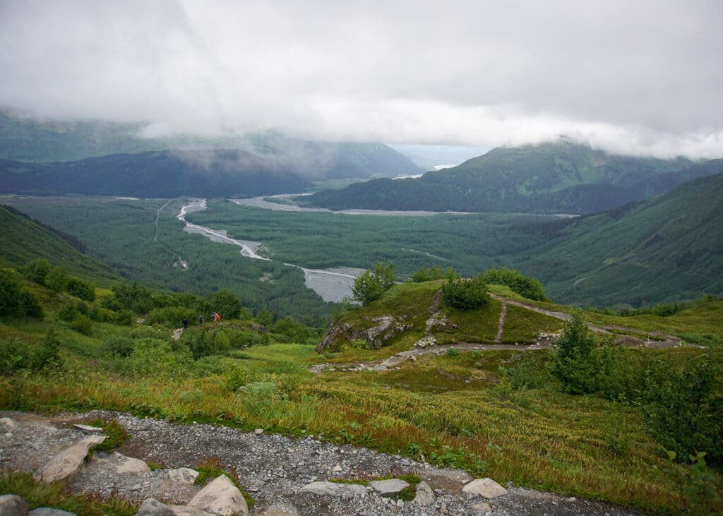
The Harding Icefield Trail is an 8.2-mile roundtrip glacier hike near Anchorage. You’ll climb the valley through cottonwood and alder forests until you make it well above treeline to a breath-taking view of the 700-square-mile Icefield.
The Harding Icefield trail can be challenging as you gain 1,000 feet of elevation with every mile. So be prepared and bring enough water. The views are worth it.
The trail starts at the Exit Glacier Nature Center parking lot in Seward. This is actually the only land access into Kenai Fjords National Park, and the main reason the national park exists today.
The trail follows a paved path and leads you to two trails. You can continue straight for the Exit Glacier Trail or take a right for the Harding Icefield Trail.
As we were walking the paved path, a few people told us they saw a bear, but we decided to continue along the trail. You should know that this is bear country and black bears are spotted almost every day from the trail.
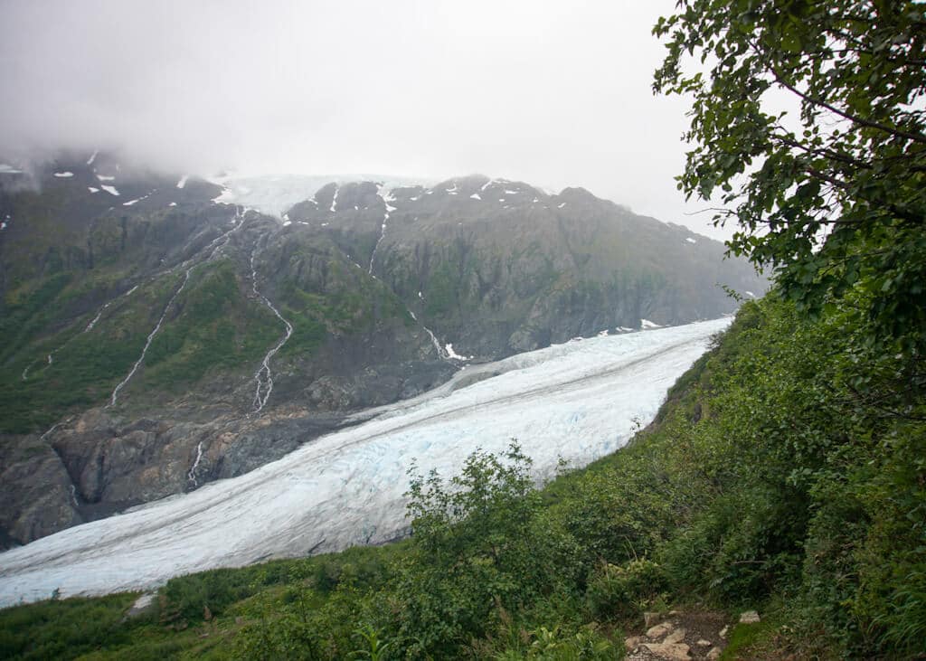
Exit Glacier
The trail continues through an aspen forest and there is a small bridge to cross within the first mile.
You’ll start to ascend the trail along switchbacks. Some steep parts may require you to use your hands to climb up.
At some spots, you’ll be able to see Exit Glacier peeking through the trees.
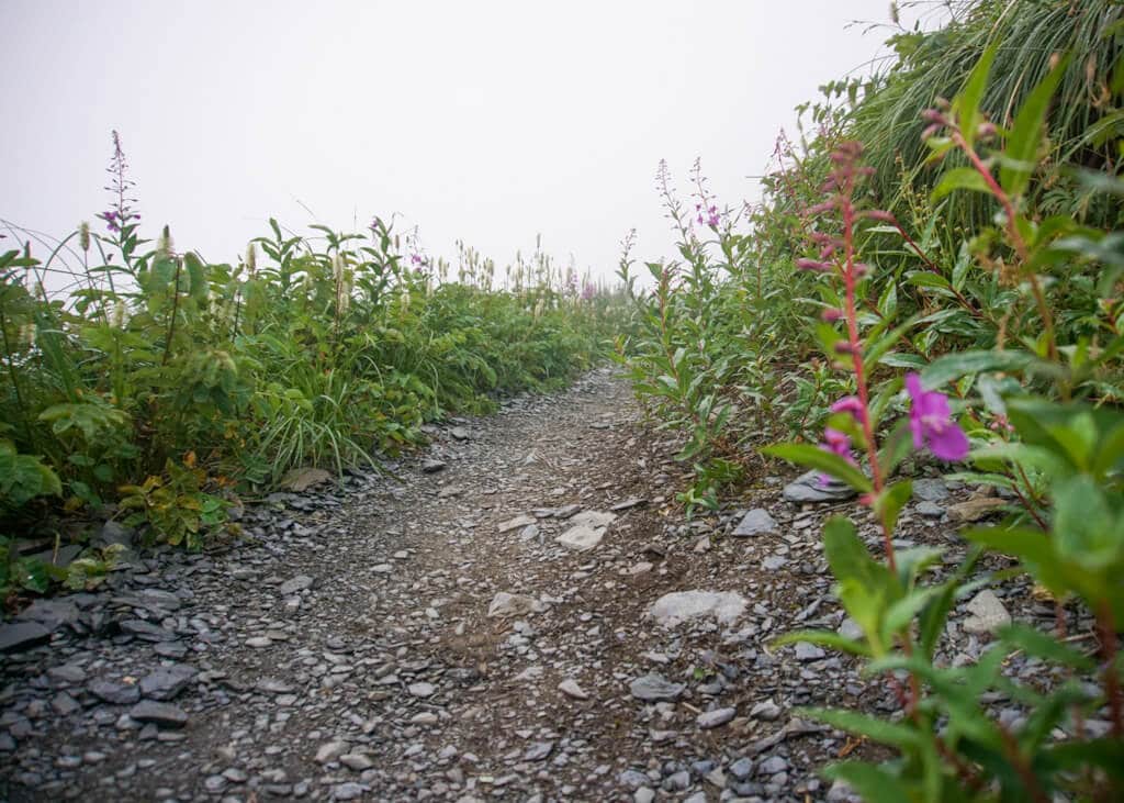
Marmot Meadows
At around mile 1.4, you’ll reach the wildflower meadows and Exit Glacier comes into view.
This is a great place to end your hike if you’re hiking Harding Icefield with young kids, or if the visibility is poor.
You’ll find a lot of awesome spots in this area to hang out or take photos.
The trail continues and the start of the switchbacks up the “cliffs” begins at mile 1.8.
Top of the Cliffs
You’ll have to climb about half a mile before reaching the top of the cliffs, which is where you’ll start to see glimpses of the Harding Icefield.
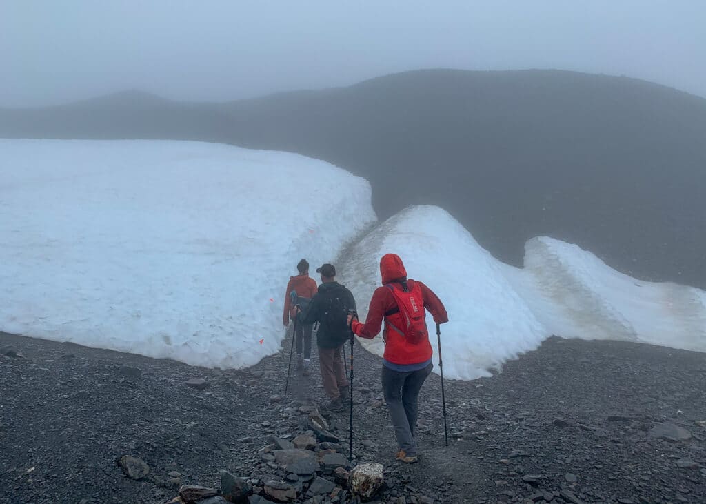
The trail turns the corner and while it’s mostly maintained with a clear path, the trail disappears as it goes through a huge section of rocks and scree, which make it easy to get a little lost if the visibility is poor.
There are areas where you may need to traverse across patches of snow. You’ll see a few orange trail markers along the path, but they can be really hard to see. I highly recommend bringing a map or GPS.
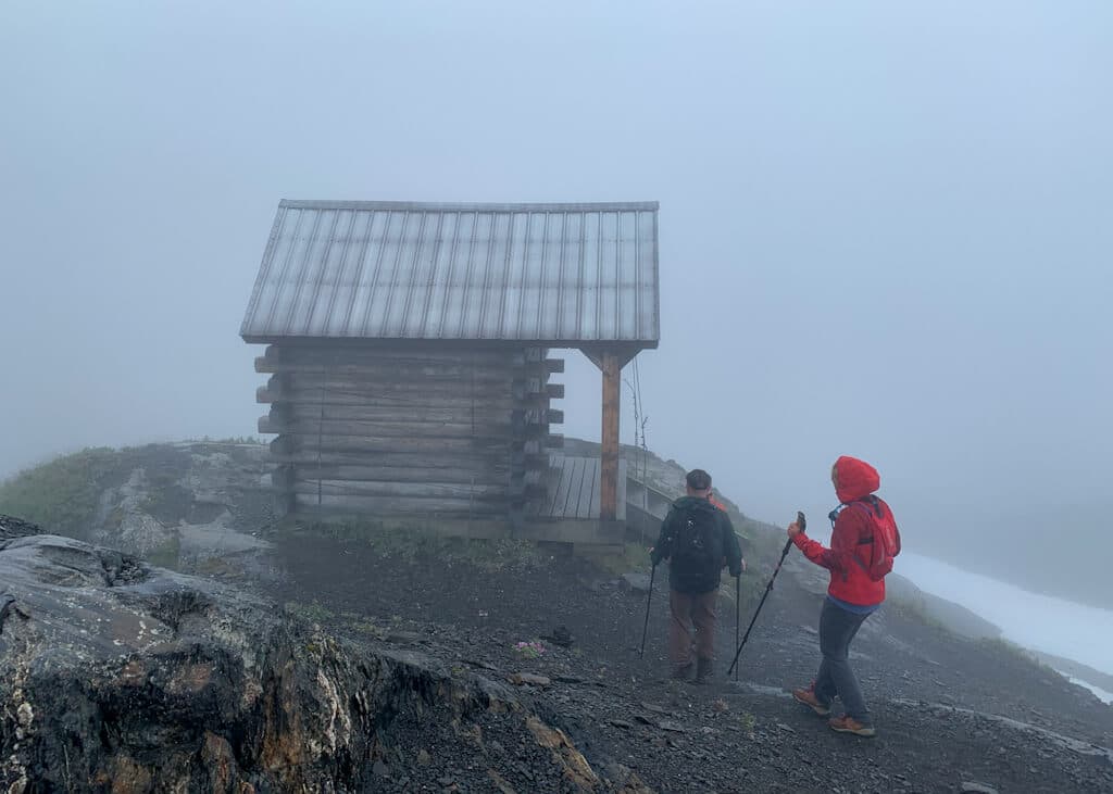
Emergency Shelter
At mile 3.9, you’ll reach the Harding Icefield emergency shelter. This shelter should only be used during bad weather and is not meant for overnight use. The elevation at this point is 3,459 feet.
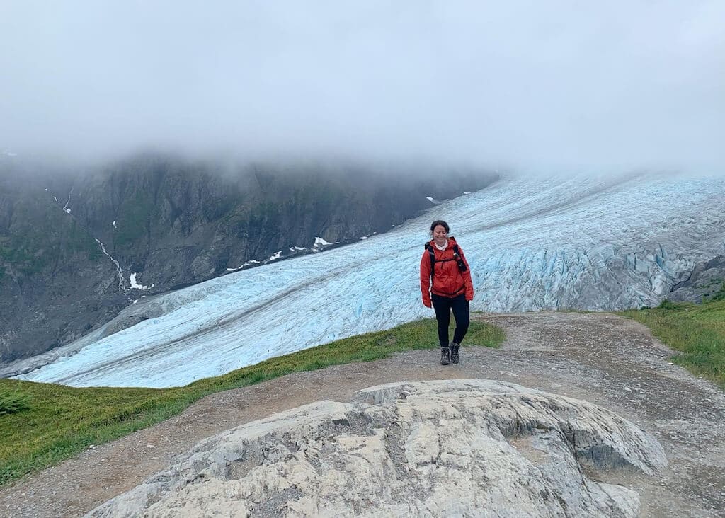
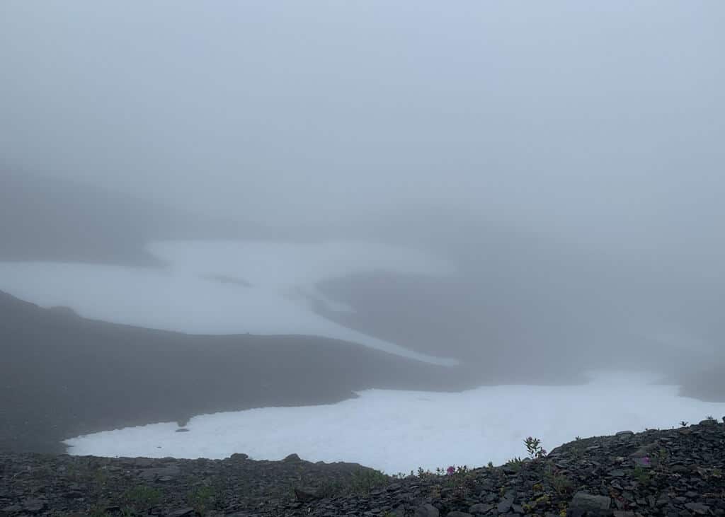
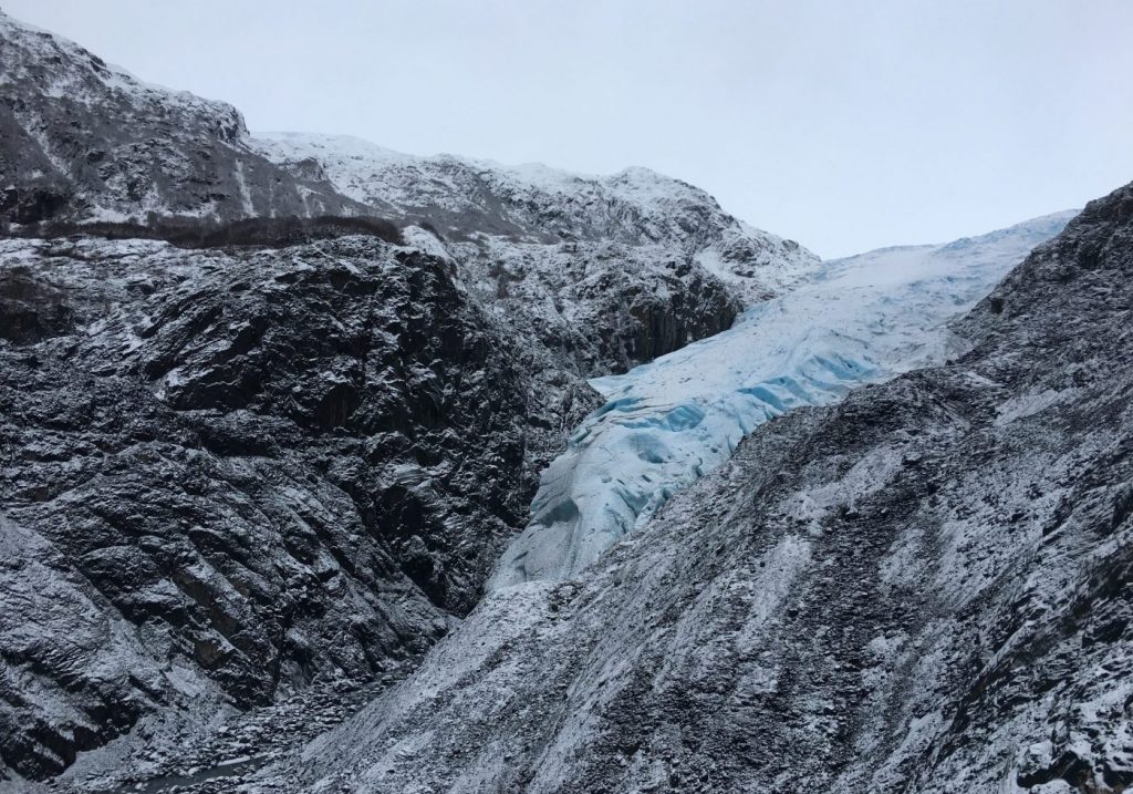
View of Harding Icefield
Hiking for another 0.2 miles will get you to views of Harding Icefield. You can only really see the icefield on a clear day so keep that in mind. This is what it looks like when it’s not clear…
The icefield is 700-square-miles and it’s majestic! If you’re not skilled in glacial travel then I would stay off of the glacier.
Watch you step as you make your way back down. There are plenty of areas where trekking poles are helpful to keeping your balance.
Camping at Harding Icefield
Camping is permitted along the Harding Icefield Trail corridor, but you must set up camp at least 1/8 mile from the trail on bare rock or snow.
A lot of people camp around Marmot Meadows. Make sure to find a camp spot that is out of sight from the trail and avoids crushing fragile vegetation.
Camping is not permitted in the emergency shelter at the top of the trail.
Hiking Harding Icefield in Winter
During the winter, the Harding Icefield Trail is covered in snow and is considered a mountaineering route.
From October to June the trail may be covered in snow and as the winter progresses you can expect snow-covered slopes, difficult route-finding, and avalanche conditions.
The road to access Harding Icefield is usually closed during the winter at mile 1.3, but still accessible by ski, bike, or on foot. Make sure to plan accordingly.
Harding Icefield Guided Hike
You can easily do this trail on your own with a trail map and the right geat. But, if you don’t feel comfortable on your own there are some Harding Icefield guided hikes in Seward that you can join.
Here are a couple of options below:
Happy hiking!
Answering Your Questions
How long is the hike to Harding Icefield?
The hike to Harding Icefield is 4.1 miles one way.
How big is the Harding Icefield?
The Harding Icefield is 700 square miles!
What is the Harding Icefield elevation gain?
The Harding Icefield elevation gain is 3,500 feet.
Pin For Later
Do you have any questions on hiking Harding Icefield Trail in Seward? Let me know in the comments.

We are debating between and overnight trip or a day hike here in July… Do you think it’s better to camp off the trail or camp in the designated camping area and get an early start on the trail as a day hike? Just worried that full packs with will make it harder on the inclines, but the satisfaction and serenity might make it worth the effort. You mentioned people camp at the meadow, would you say it’s easy to find a flat enough spot for a tent at that location?
If you are backpackers, you will be very happy with your decision to camp up top, especially if the weather forecast is clear and you want some solitude. Lots of places to pitch a tent!