Eagle River is just a short drive north of Anchorage and offers easy access to incredible hiking trails in the Chugach Mountains.
From waterfalls to glacial-fed lakes, here are the best hikes in Eagle River, Alaska.
5 Eagle River Hikes To Try
How to get to Eagle River
Eagle River is conveniently located 13 miles north of Anchorage. It usually takes less than 20 minutes to drive there. Follow the Glenn Highway north and take either the south or north exit towards Eagle River. The exit you take will depend on which hike you want to go on.
1. Eagle and Symphony Lakes
Distance: 12 miles
Time: 5 hours
Elevation Gain: 850 feet
Difficulty: Moderate
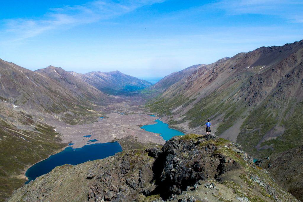
The South Fork Eagle River Trail climbs above the trees and up the valley before dropping into the valley. You’ll cross a bridge over the South Fork Eagle River and eventually make it to the boulder field.
The hardest part of the trail is crossing the boulder field. Try to stay to the left. Be cautious for your small children and pets which may need assistance over this section.
At the end of the trail, you’ll find two glacial lakes that contrast in color. Eagle Lake is a green milky color and Symphony Lake is a rich blue aquamarine color.
Click here to read the full Eagle and Symphony Lakes Trail Guide.
How to get to Eagle and Symphony Lakes
Take the Glenn Highway to the Eagle River Loop Road exit and take the first right at Hiland Road. Follow Highland Road for several miles and turn right on South Creek Road. Take another right on West Creek Drive. The parking area for the Eagle and Symphony Lakes trailhead will be on your left.
2. Rendezvous Ridge (Triangle Peak to Eagle and Symphony Lakes Loop)
Distance: 16 miles
Time: 8 hours
Elevation Gain: 6,820 feet
Difficulty: Difficult
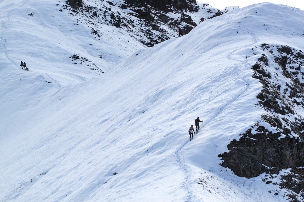
This trail follows the South Fork Eagle River Trail as it climbs above the trees and up the valley before you’ll take the trail up the right side towards Rendezvous Peak. As you climb up, you’ll stay left to make it to the ridge.
Continue along the ridge for about five miles before making it to the summit of Triangle Peak. Once you make it here, you can drop down into the valley back towards Eagle and Symphony Lakes and follow the main trail back to the trailhead.
The views from the ridge are amazing. I love doing this hike in late fall or early winter, especially after a fresh snowfall. Rendezvous Ridge is my favorite hike in Eagle River.
How to get to Rendezvous Ridge
Take the Glenn Highway to the Eagle River Loop Road exit and take the first right at Hiland Road. Follow Highland Road for several miles and turn right on South Creek Road. Take another right on West Creek Drive. The parking area for Rendezvous Ridge trailhead will be on your left.
3. Mt. Baldy
Distance: 3 miles
Time: 2 hours
Elevation Gain: 1,500 feet
Difficulty: Moderate
Mt. Baldy is a popular hike in the Eagle River area. This trail gets right to it. I like to compare it to Flattop Mountain Tail in Anchorage. The trail is steep but offers some switchbacks. Eventually it’s just a scramble up and can be difficult to hike up without ice grips during the wintertime.
It always seems to be super windy and cold at the top so make sure you bring your layers! But the views of the surrounding area are amazing from the top and you can even see Denali on a clear day.
BONUS HIKE: If you continue further past Mt. Baldy, you can make it to Black Tail Rocks and Round Top. They offer great views of the glacial valley below.
How to get to Mt. Baldy
Take the Glenn Highway to the Eagle River Loop Road exit and follow for a few miles before turning right onto W Skyline Drive. Continue straight onto Jamie Drive. Continue onto McCrary Road. Turn right onto Upper Skyline Drive. Upper Skyline Drive turns right and becomes Canyon View Drive. Canyon View Drive turns slightly left and becomes Golden Eagle Drive. At the end of the road, you will find the trailhead parking. The parking area can be full on a nice day, so it’s okay to park alongside the road.

4. Eagle River Nature Center
Distance: 1.5 to 24 miles
Time: 1 to 8+ hours
Elevation Gain: Varies
Difficulty: Easy to Difficult
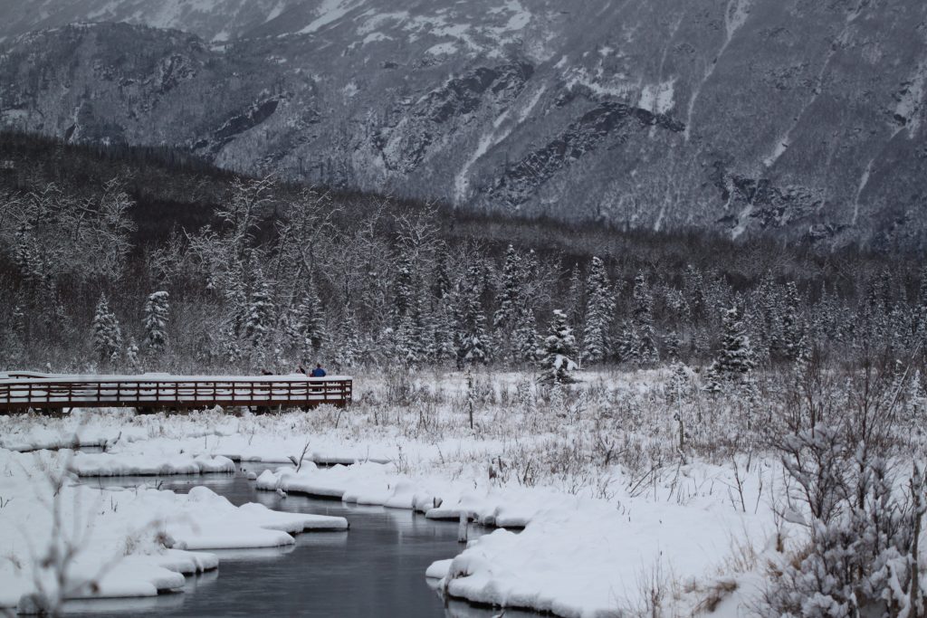
The Eagle River Nature Center offers plenty of hiking opportunities and public use facilities. There are short hikes like Rodak Trail and Albert Loop Trail (3 miles), and there are longer hikes like Echo Bend Trail (6 miles roundtrip). The main trail is also part of the 24-mile Crow Pass Trail to Girdwood, but most people start this hike from Girdwood.
Here is the Eagle River Nature Center Trail Map.
There are also several yurts available to rent along the trail if you wanted to stay overnight. During the wintertime, these trails are great for cross-country skiing and snowshoeing.
A daily parking fee or season pass for parking is required for the Nature Center, which offers many interpretive programs and presentations throughout the year.
How to get to the Eagle River Nature Center
Take the Glenn Highway to the Eagle River Loop Road exit and follow the road until you will take a right at Eagle River Road. Follow Eagle River Road for almost 11 miles and you will find the Eagle River Nature Center parking lot at the end of the road.
5. Barbara Falls
Distance: 1 mile
Time: 1 hour
Elevation Gain: 101 feet
Difficulty: Very Easy
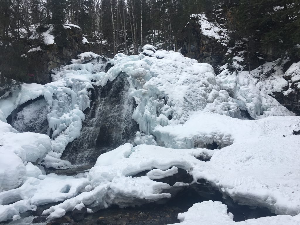
This quick and very easy trail takes you to a waterfall with two different viewpoints. You can see Barbara Falls (also known as South Fork Falls) from an upper and lower viewpoint. The trail is mostly flat and makes for a great winter hike, especially when the waterfall freezes.
Click here to read the full Barbara Falls trail guide.
How to get to Barbara Falls
Take the Glenn Highway to the Eagle River Loop Rd exit and take the first right at Hiland Rd. Turn left at River View Dr, left at Waterfall Dr., right on River Park Dr., and left on Ken Logan Circle. The parking for the Barbara Falls trailhead is in a cul-de-sac and the trail starts behind the metal gate. Please be respectful of the private property and do not park in front of the NO PARKING signs.
More Eagle River Hikes
If you’ve already bagged the hikes that I listed above, some lesser-known trails in Eagle River that you can hike are Harp Mountain, Hanging Valley Lake, Hurdygurdy Mountain, and Hiland Mountain.
Pin For Later
Did you have any questions on the best hikes in Eagle River, Alaska? Leave them in the comments.

I just moved here and am loving your blog! Have you stayed at any of the yurts accessed from Eagle River Nature Center? If so, I’d love a review!
Hi Stella! I’m so happy you’re loving it. That means so much to me. 😀 I have yet to stay at the yurts around ERNC but I know a lot of people that love them! I’m shifting into winter content so check back for some fun trip ideas. And, welcome to Alaska! It’s an incredible place to experience.