Iceberg Lake to Bremner Mine is one of the best backpacking trips in Wrangell St. Elias National Park, but the only way to access this remote area is by flying in and out on a small bush plane from the small town of McCarthy.
This 40-mile route (as the crow flies) from Iceberg Lake to Bremner Mine is commonly known as Seven Pass Route. You’ll hike through some incredible terrain within the Chugach Mountains in Wrangell St. Elias National Park, the largest national park in the United States.
After being dropped off in the remote backcountry, you will have to find your own way across glaciers and rivers, climb high mountain passes, and bushwack through thick alders.
There are no trails to follow here, which makes hiking this route incredibly challenging, both physically and mentally. It’s definitely not the place to go for your first backpacking trip.
In this post, I’m going to share my experience backpacking Iceberg Lake to Bremner Mine in Wrangell St. Elias National Park.
The photos that I share in this post are from July.
Backpacking Seven Pass Route in Alaska: Iceberg Lake to Bremner Mine
Traditional Land: Ahtna, Denendeh (Visit Native-Land.ca to identify whose land you live, work, and play on.)
Distance: 40 miles one-way
Time: 7-9 Days
Elevation Gain: 14,000 feet
Difficulty: Strenuous
Dogs: Yes
Wrangell-St. Elias National Park and Preserve Maps and Resources
Here are some maps and books to help you plan your route:
- National Park Service Wrangell St. Elias Area Map
- Wrangell-St. Elias National Park and Preserve (National Geographic Trails Illustrated Map)
- Hiking Alaska’s Wrangell-St. Elias National Park and Preserve
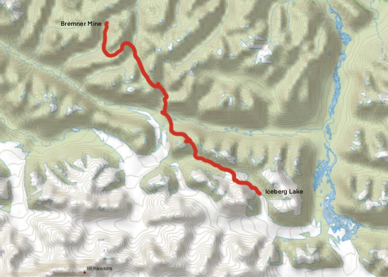
Iceberg Lake to Bremner Mine Track
Iceberg Lake (60.809350, -143.000200) to Bremner Mine (61.044738, -143.427050).
I’ve intentionally left out my GPS track for this route so that you can have fun planning out your own adventure!
It’s also important to note that the landscape here changes over time so what worked for me during my trip may not be the best route for you during your trip.
However, if you need some waypoints or have any questions regarding the route, don’t hesitate to reach out to me.
Quick Tips
- Book your air service well in advance
- Plan to carry an extra day’s worth of food in case you get weathered in
- Expect all kinds of weather conditions and bring the right gear for it
- Not all brands of fuel canisters are allowed
- Buy or download your maps before arriving in McCarthy
- Contact the National Park Service for help planning your trip
How to get to McCarthy from Anchorage
McCarthy is located 307 miles east of Anchorage, which is a 6.5-hour drive.
- From Anchorage, head north on the Glenn Highway
- Exit towards Palmer and continue along the Glenn Highway to Glennallen
- Turn right at the Richardson Highway
- Continue south and turn left at the Edgerton Highway and drive to Chitina
- Continue through Chitina and follow McCarthy Road
- The road ends at the Kennicott River, just to the west of McCarthy
McCarthy Road is a 59-mile-long gravel road and drivers should be cautious of poor road conditions. The road has improved over the years but it’s still slow going.
If you are renting a car, make sure to check road restrictions. Some rental companies don’t allow you to drive on certain roads in Alaska, including McCarthy Road.
Overnight Camping & Parking
Once you reach the end of the road, you can park in the designated areas according to posted signs near the footbridge. Free parking is limited, but there is more parking and camping available on private property, for a fee.
We paid for two nights of camping, which was $25/night. We also paid for 10 days of parking, which was $10/day per vehicle.
Getting Into McCarthy
In order to get into the town of McCarthy, you must walk over the McCarthy footbridge. From there, a free shuttle will take you and your backpack into McCarthy.
If you don’t feel like waiting for a shuttle, you can walk 1.2 miles on the road or try to hitch a ride from one of the friendly locals.
Planning a Route
Best Season
Due to the location of this route, it’s best to plan a multi-day backpacking trip from late June to September. July is the warmest month of the year in Alaska and tends to see less rainfall than August and September. Patches of snow may still be found in June and July.
Summer brings plenty of daylight hours in Alaska, so you have more than enough time to hike long days if you want to. Temps ranged from mid 30s F to high 60s F.
Where to Start From
The Seven Pass Route is about 40 miles long and traverses the Chugach Mountains in Wrangell St. Elias National Park.
You can either start this trip from Iceberg Lake or from Historic Bremner Mine. Both of these locations can only be accessed by bush planes.
Most guided trips in this area start from Bremner Mine and end at Iceberg Lake because the weather tends to be better at Iceberg Lake, which means it’s much easier to get out on time.
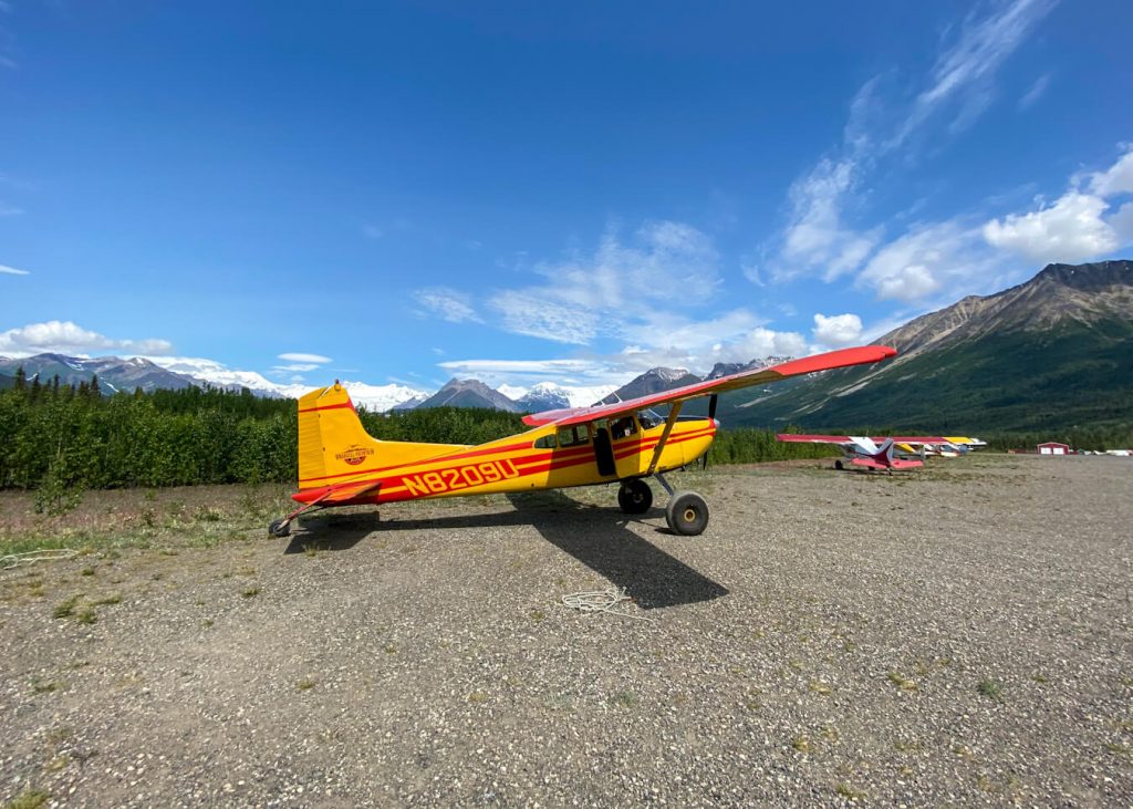
How to Arrange Bush Flights
We booked our backcountry flights with Wrangell Mountain Air, which operates out of McCarthy. We ended up using three flights for our group size of eight people, which brought the round-trip flight cost to $575 per person.
You can choose your drop-off and pick-up locations. It’s common to get dropped off at Iceberg Lake or Bremner Mine but there are also plenty of ways to extend your trip so these may change based on the trip you want.
Wrangell Mountain Air does a great job trying to spread out any groups that are heading into the backcountry to avoid directly overlapping with another group. However, you may end up passing a group heading in the opposite direction from you.
How Many Days Do You Need?
Most people plan 7 to 9 days to backpack the entire route. We had 8 days to hike 40 miles from Iceberg Lake to Bremner Mine and I think it was the perfect amount of time. Some days were longer and more difficult than others, but it was manageable.
Where to Stay: Campsites
There are no established campsites in this area. You will be camping in the remote backcountry and you will need to scout the best places to camp, which may be on the glacier, near an alpine lake, or amongst the tundra.
It’s recommended to use the triangle method when camping, which means you will set up your tent 100 feet away from your cooking area and another 100 feet from your food storage area. These locations will create a triangle shape.
Make sure you are prepared to follow Leave No Trace Principles during your trip.
Trail Conditions
This route takes you through diverse terrain. You should be prepared for glacier crossings, river crossings, lots of boulder hopping, bushwhacking through bear territory, and about 14,000 feet of elevation gain.
I don’t recommend this trip for beginner backpackers due to the terrain that you will have to navigate on the route. It’s important to have the skills necessary to make safe decisions while in the remote backcountry.
My 8-Day Backpacking Route
Day 1 – Iceberg Lake to Glacier
Daily Miles: 4.36 miles; Total Time: 4 hours, 9 minutes
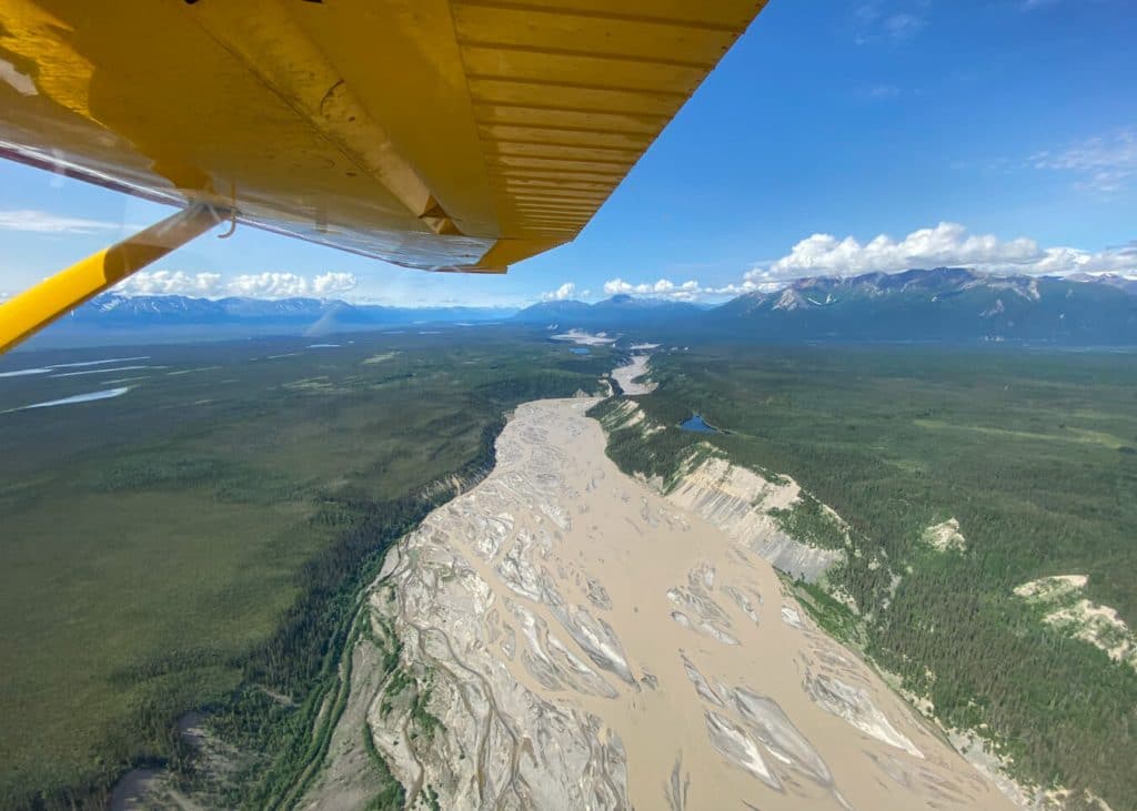
We met at Wrangell Mountain Air in McCarthy and hopped on a shuttle to the McCarthy Airstrip. We met our pilot, Bill, and took off in a small bush plane at noon.
After a 35-minute flight through some of the most beautiful scenery I have ever seen outside of a plane window, we landed on the sandy airstrip at Iceberg Lake.
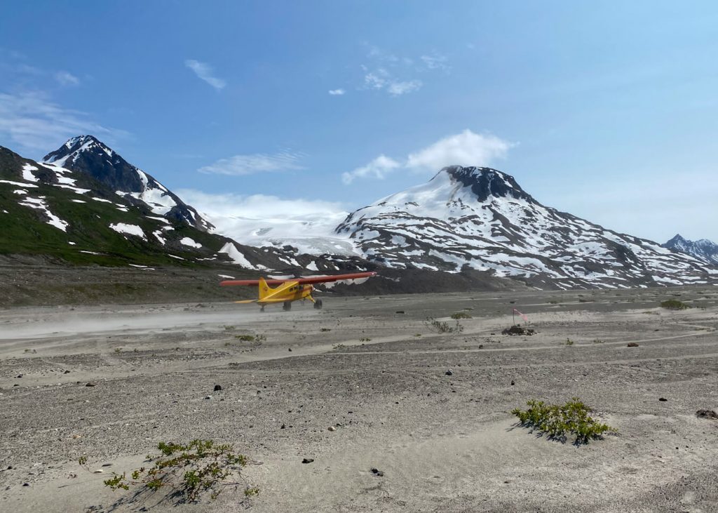
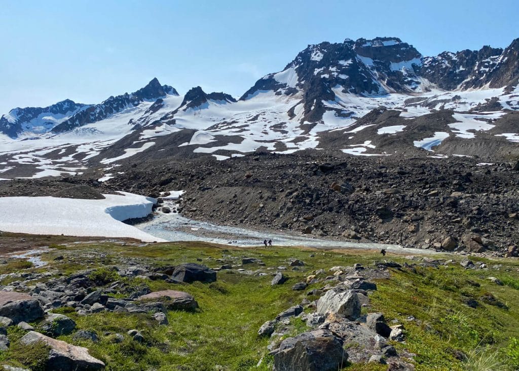
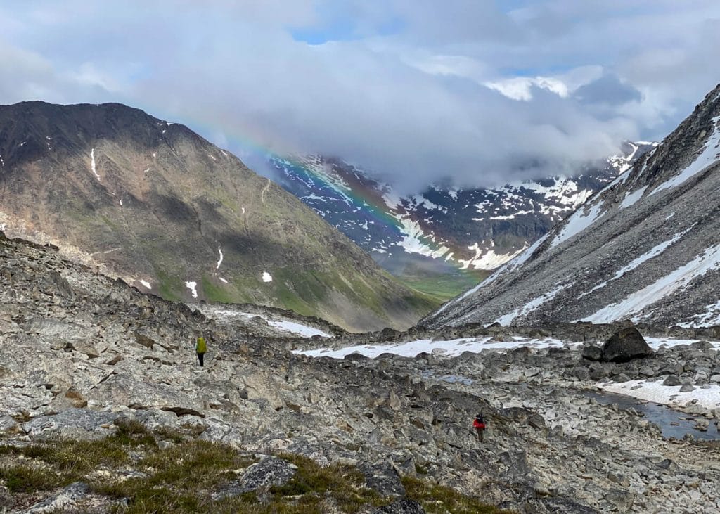
We dropped our heavy packs (mine weighed 43 pounds) on the airstrip and spent the early afternoon hiking towards Iceberg Lake, which is formed when the glacier creates a dam and blocks off the river that flows down the valley.
This lake is known for an event called jökulhlaup, an Icelandic term meaning “glacial outburst floods.” If there are large icebergs floating in the lake before the water rushes out, these same icebergs will be left stranded on the sandy lake bottom, and it just looks really cool.
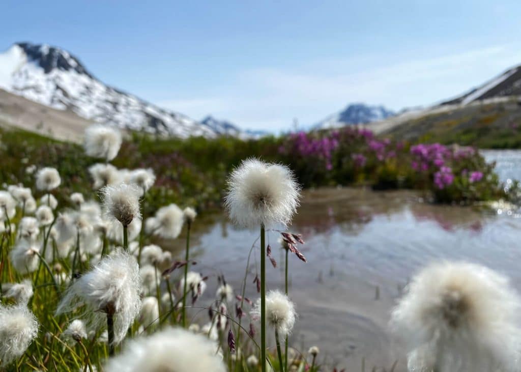
Even though we didn’t make it all the way to the lake, I really enjoyed wandering through this area. I was mesmerized by the silty streams that flowed down the mountains, and the wildflowers that filled the valley floor.
We made our way back to the airstrip, picked up our packs, and started our 8-day backcountry adventure towards Bremner Mine.
From the airstrip, we stayed left of the river and came across our first obstacle, which was a small water crossing. We scoped out a route that allowed us to cross using large rocks. We continued up the valley, passing a beautiful, glacial-fed lake.
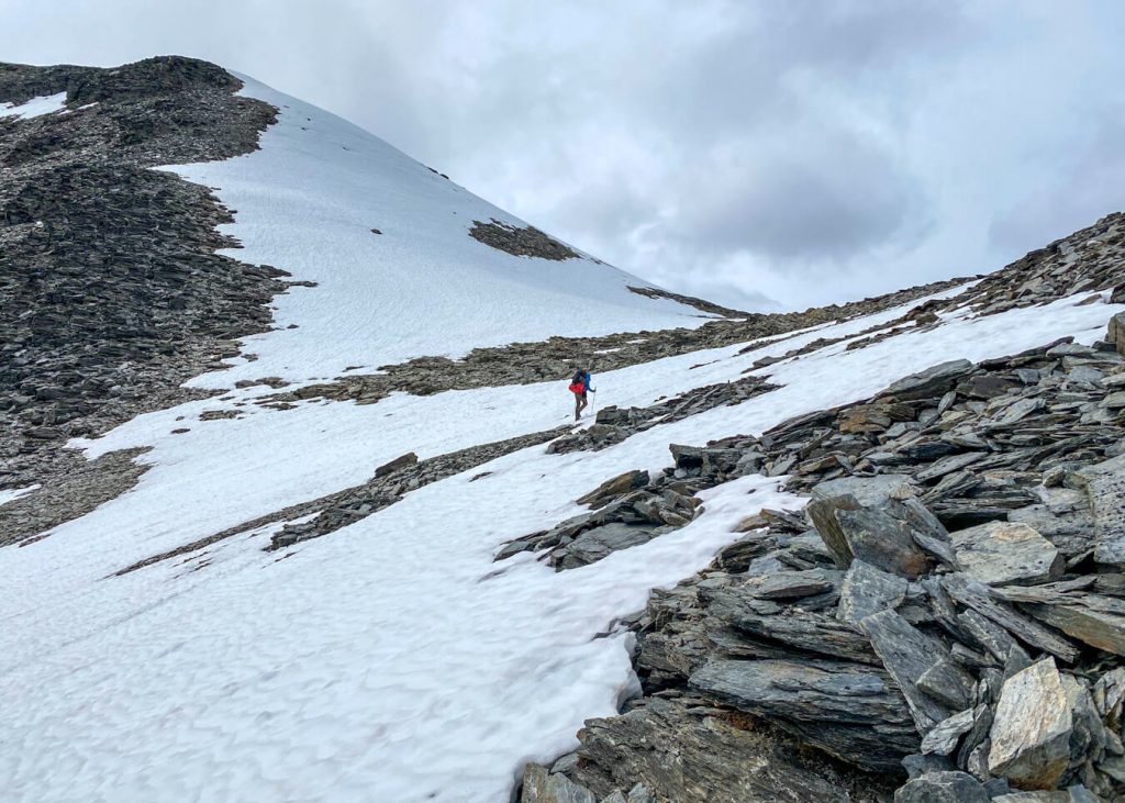
Soon, we found ourselves traversing across a glacier. We tried to stay on a route that avoided snow-covered sections of the glacier.
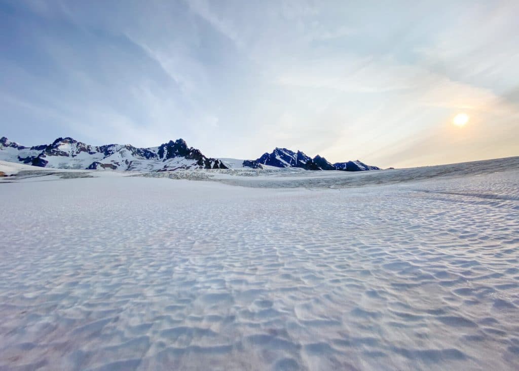
However, we found ourselves sketchily hiking through some snow patches. There were even some parts that were wet and slushy because the sun was shining all day causing a lot of snowmelt.
I ended up slipping and hitting the ice, which was frustrating. It wasn’t until a few days passed by that I noticed my whole thigh was covered in bruises.
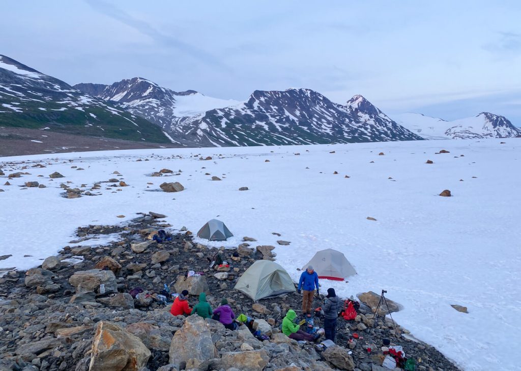
As the sun started to set and the air was getting colder, we decided to set up camp on top of the glacier. I never anticipated that we would camp on top of a glacier, but I’m so glad I packed my 20-degree sleeping bag because I slept comfortably.
Day 2 – Glacier to Alpine Lake
Daily Miles: 8.65 miles; Total Time: 8 hours, 16 minutes
We awoke to another beautiful day in Wrangell St. Elias. We made our way off of the glacier and found ourselves walking parallel to the river that flowed through the valley. We wanted to stay lower in the valley to avoid side-hilling and bushwacking through patches of alder.
It became marshy near the river and everything started to become a slosh. It was then that I figured it was going to be very difficult to keep my feet dry during this trip.
The first pass we had to climb was coming up quickly. We found a gully with a creek flowing through it and some of it was still covered in snow. We started our climb up the pass and even got to practice some of our bushwacking skills! Yipee.

Along with the bushwacking came all of the mosquitoes. Deet is definitely not a great deterrent for these guys out there.
It was a very hot day (high 60s), which made it quite exhausting. I had to refill my water supply from the creek. As we climbed higher, it was pretty cool to look back towards the glacier and valley we just walked through.
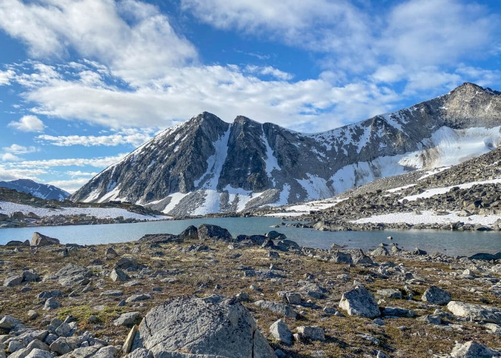
We continued to hike through the pass until we reach a beautiful alpine lake where we set up camp for the night. Since the weather was still amazing, we went for a little skinny dip! It was very cold but very refreshing.

This was the longest mileage day of the entire week and I could feel it. I was ready to eat dinner and chill. After dinner, we enjoyed a beautiful sunset before getting cozy in our tents.
Around 11 p.m., shortly after most of us fell asleep, a grizzly bear ran across the ridge behind us. Only one person in our group actually saw this happen. This would be the first of many bear sightings during our backcountry adventure.
Day 3 – Alpine Lake to Tana Lobe of Bremner Glacier
Daily Miles: 6.37 miles; Total Time: 9 hours, 1 minute
I seriously couldn’t have asked for better weather. It was another beautiful, sunny day. I started off the morning drinking a coffee with Bailey’s.
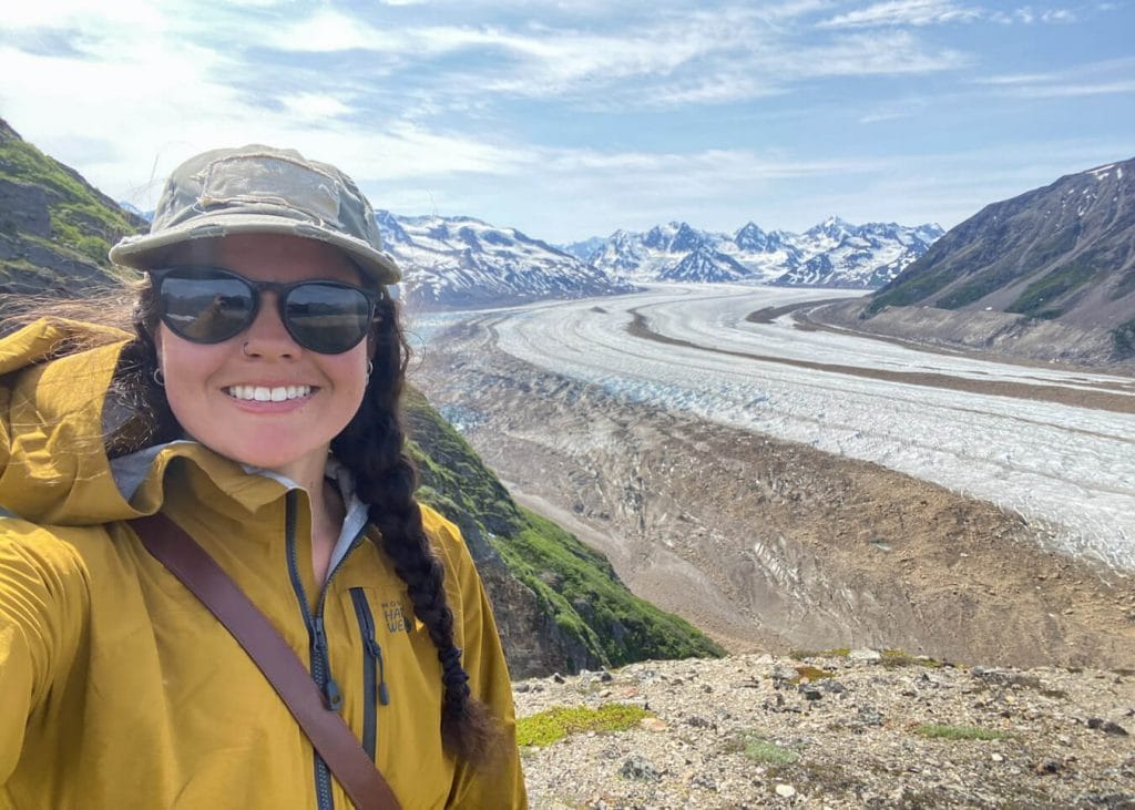
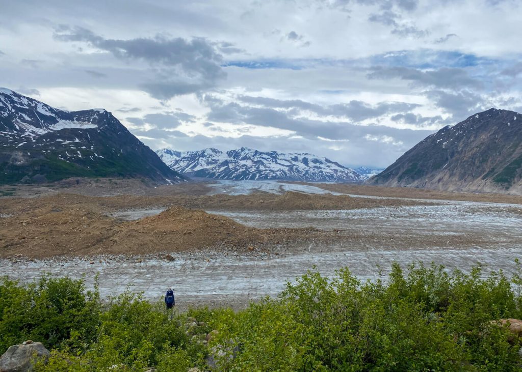
Leaving the alpine lake, we made our way towards Bremner Glacier. We hiked downhill and stopped at a scenic overlook of the glacier.
We almost didn’t hike up the extra 15 minutes to get to this overlook, but I’m so glad we did! The view was epic! From here, we were able to scout our route for the traverse across the glacier.
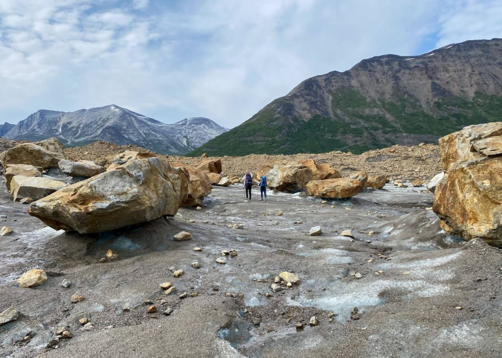
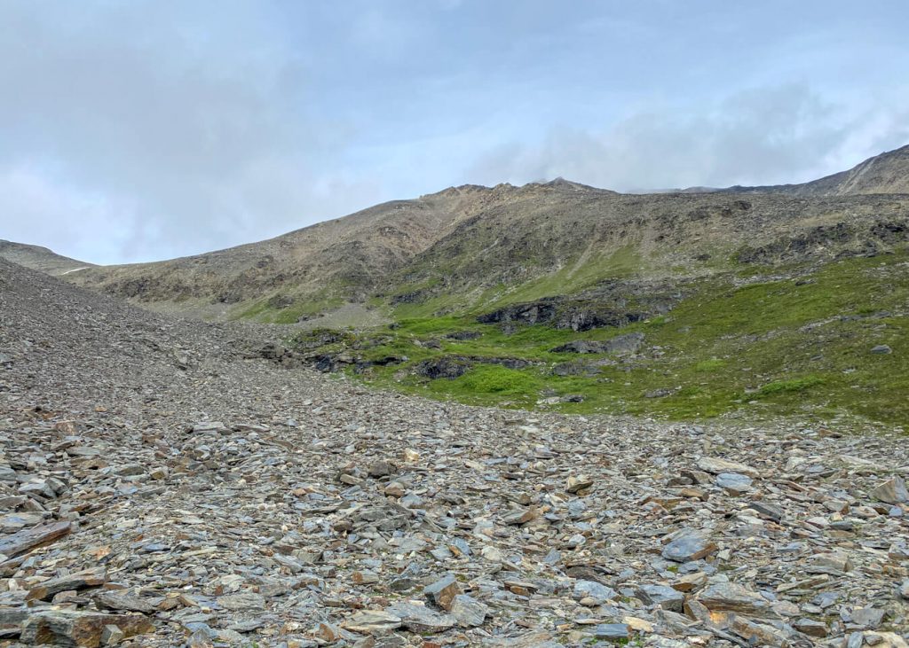
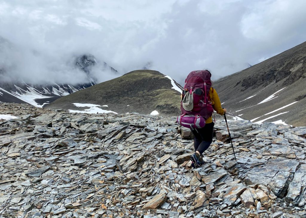
We took a gully down to reach the glacier. The landscape was really cool with red rocks and massive boulders.
We found ourselves entering the moraines of the glacier. This quickly turned into hiking through narrow canyons filled with boulders the size of cars. We tried to be extra careful not to kick or disturb loose rocks because it could’ve turned into a dangerous situation.

What was supposed to be the easy day traveling across the glacier “highway” was actually the most difficult. It took us a lot of time to make our way through the moraines until we managed to find some glacier ice we could easily walk across.
After a lot more boulder hopping through moraines, we were able to cross the Tana Lobe of Bremner Glacier. We had to navigate some crevasses and we also the most massive erratic rock.
It was getting late and we were feeling exhausted, so we made the decision to camp on the west side of the glacier just below the next pass we would have to climb.
That evening, we walked around on the glacier and saw a black bear on the ridge above us. It was another night I was very glad I had my 20-degree sleeping bag.
Day 4 – Bremner Glacier to Alpine Lake
Daily Miles: 5.99 miles; Total Time: 9 hours, 56 minutes
Our mornings seemed to get earlier and earlier. We awoke in anticipation of a very long day bushwhacking 2.5 miles through thick alders. Today was supposed to be the most difficult day.
We packed up camp and were well on our way by 8:30 a.m. Since we camped on the west side of the glacier, we had to backtrack a short distance to get to the start of our climb up the pass.
After our initial climb, we decided to stay high. We heard about an elusive high trail that would allow us to avoid so much bushwacking. I believe we found it! It was a game trail that climbed the right side of the valley before slowly dropping down to the river.
Yes, we had to bushwack and it wasn’t fun. However, it wasn’t even close to the amount of mileage we thought we would have to bushwack through.
We actually scared off a black bear that we saw running down the valley. I think it was the same one we saw the night before.
Higher up the valley, the river split into a Y. It took a while to scout a good place to cross the river. The weather was starting to change as tiny droplets of rain started sprinkling from the sky.
We managed to find a spot just above the Y. It wasn’t the easiest crossing, and I was glad some of the guys were on the other side to help us to the other side. We had another section to cross shortly after this which was easier but much deeper as the water just grazed my butt.
After taking a lunch break, we continued hiking up the pass. Eventually, we were in the middle of a large boulder field.
The day was very long but we set up camp at another beautiful alpine lake. I took some time to soak my feet in the lake which felt great.
Day 5 – Alpine Lake to Monahan Creek Valley
Daily Miles: 6.58 miles; Total Time: 6 hours, 5 minutes
It was hard to get out of my sleeping bag with the cold temperatures at the lake. That is, until the sun started to peek out. We crossed snow patches and hopped way more boulders as we hiked down into Monahan Creek Valley.
The valley was full of big rocks, but it was actually pretty easy walking, which was refreshing.
We stopped to have lunch by the canyon and I spotted a grizzly on the other side of the valley. I pulled out my binoculars to get a better look at it.
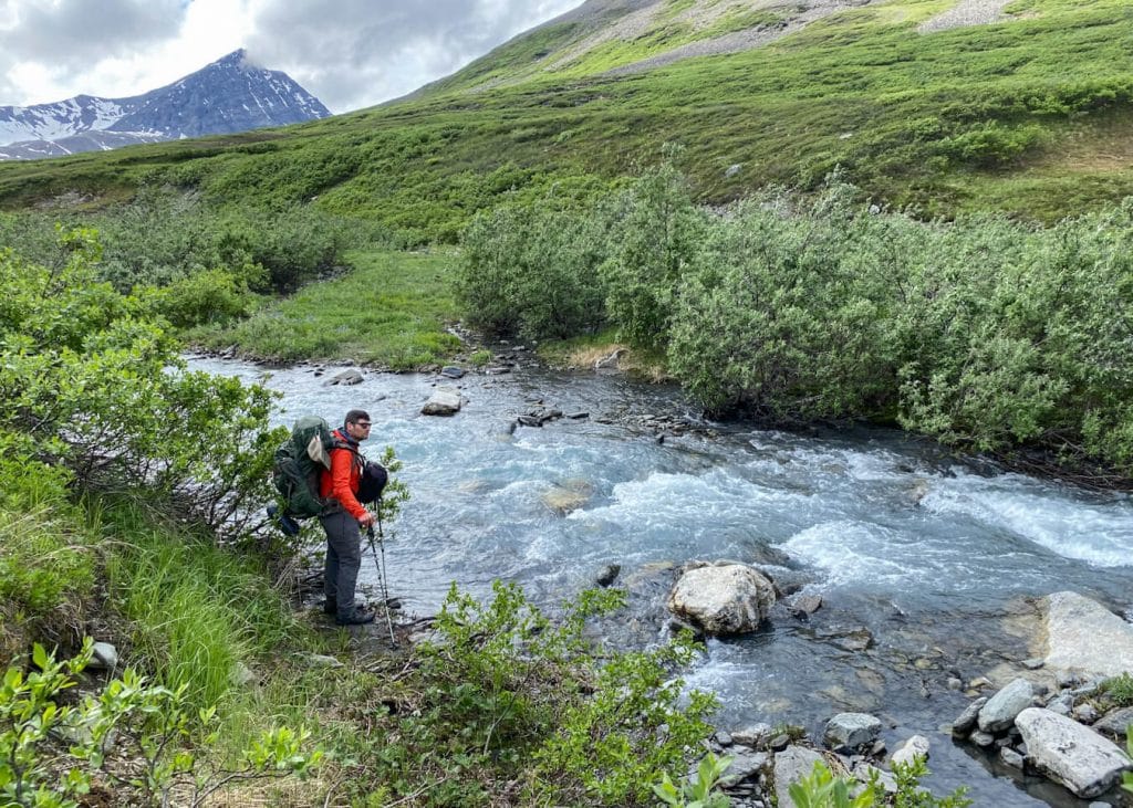
After lunch, we had to scout a place to cross Monahan Creek. We continued down to the valley floor where we concluded that the creek was more like a river! It took us a while to find the best place to cross. We ended up crossing the creek in two sections.
We decided to have an early day and set up camp in a lovely meadow just below the next pass. It felt amazing to have time to chill and rest up for the big pass the next day. I took the best nap ever that day.

Day 6 – High Pass to Alpine Lake
Daily Miles: 2.9 miles; Total Time: 5 hours, 22 minutes
A black bear greeted us in the morning hours. The bear came from the direction of the pass we were going to be climbing and continued into the alders. We barely noticed it spying on us as we started the initial climb up the pass.
We expected this day to be challenging as many people mentioned how difficult the climb was. We would have to climb 2,000 feet of elevation in 1.5 miles to make it to the crest.
It was mostly talus along the way up. The footing was not too difficult on the way up, but there were very small sections of scree that were a little bit difficult to get up. There was also a small field of snow near the top of the pass that we had to hike through.
It took us about 2.5 hours to hike from the meadow to the top of the pass. It ended up feeling a lot less difficult than anticipated.
At the top of the pass, we enjoyed taking a break for lunch. It actually started to get chilly so we continued hiking to find our next campsite.
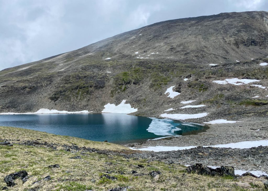
The way down was very rocky. A partially ice-covered alpine lake quickly came into view. We decided to hike a little bit lower to another alpine lake and make camp. We set up camp on a grassy knoll overlooking a beautiful blue-green alpine lake.
This was the first day that the weather wasn’t so great. The rain started to drop down as we were pitching our tents. It became socked in and even started snowing!
While we were cooking in the shelter, I heard something outside. I took a peek underneath the shelter and noticed people that weren’t part of our group. Another group was heading out in the opposite way of us and ended up camping nearby.
Day 7 – Alpine Lake to Historic Bremner Mine
Daily Miles: 4.89 miles; Total Time: 3 hours, 21 minutes
It was exciting to wake up and know that it was our last big hiking day. We headed out in the rain towards our final destination, the Historic Bremner Mine.
Bremner Historic Mining District is an abandoned mining camp located 30 miles southwest of McCarthy in Wrangell St. Elias National Park. Gold was discovered here in 1901 and lots of ruins still remain.
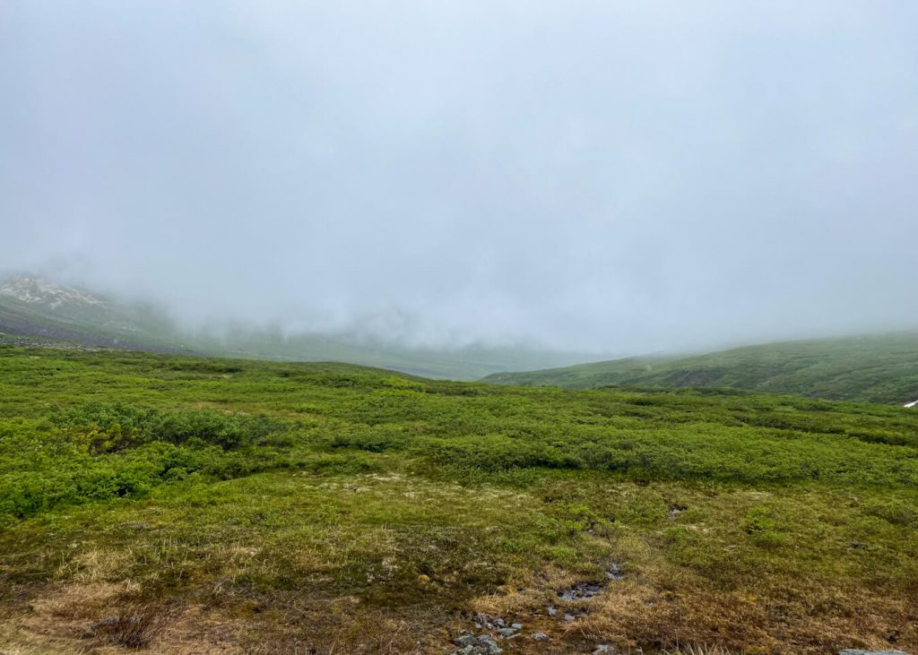
We headed north through Standard Creek and Golconda Creek. Everything was lush and green. We soon stumbled upon one of the old, historic buildings and found our way to the Bremner Airstrip.
Another seemingly long and flat 1.2-mile hike from the airstrip would lead us to the rest of the historic buildings from the 1930s and 1940s, as well as the Bremner Bunkhouse (61.044738, -143.427050), which serves as a refuge for backcountry travelers.
The bunkhouse is not a public use cabin because it is on the National Register of Historic Places. It’s equipped with a lot of fun things like a maker space, which is part of the Bunkhouse Art Project, games, a visitors log, and lots of reading books.

With the current weather conditions being less than ideal, the bunkhouse was a cozy delight. We were able to start a fire in the woodstove to warm up and dry out our gear.
We could only hope that we would get out as scheduled the following day.
Day 8 – Bremner Airstrip
Daily Miles: 1.2 miles; Total Time: 30 minutes
Communications with Wrangell Mountain Air made us ready for the first flight scheduled out of Bremner Mine at 9 a.m.
Due to the weather conditions in the morning, we were unsure if we would be able to get out. The first flight with two people on board managed to leave right on time as the rest of us prepared to hike 1.2 miles to the airstrip for the next scheduled flight out.
The weather started to worsen. We had to mix up some of our groups to lighten the load of the other plane. I left on the second flight out with one other person in our group.
The flight back to McCarthy took 20 minutes. The views were amazing but the weather continued to get worse. We met some of our group at the Roadside Potatohead for our first post-hike meal.

It was a while before the van pulled up. That was the moment we found out that only two out of the remaining four people were able to get out of Bremner Mine.
The weather conditions got worse and they told the last two people to not expect a pick up for up to three days! This is exactly why it’s important to pack extra food.
We were all pretty bummed after hearing this. The day went on but we eventually got some news that they would try to pick up the rest of our party around 2 p.m. Thankfully, we were all reunited around 3 p.m.
If you eat at La Potato, I definitely recommend the breakfast burrito!
Instead of camping in McCarthy for the night, we drove back to Anchorage. It was a long drive but getting to shower that night was everything.
After totaling the mileage for this trip, we hiked 39.74 miles from Iceberg Lake to the Bremner Bunkhouse. We averaged about 1 mile/hour. The terrain was very difficult and my knees and knuckles ached for a whole week after we got back.
I really enjoyed our group dynamics and just had a really fun and rewarding experience in the backcountry. This trail is truly one of the best backpacking trails in Alaska. I would love to go out and hike another route within Wrangell St. Elias National Park.
Safety Tips
Backpacking in Alaska’s remote backcountry presents a lot of challenges. You should be comfortable route finding, using navigation devices and maps, traversing various terrains like glaciers and rivers, and know how to handle any unexpected injuries or other emergencies.
I’ve noted a few things to think about in regards to safety below.
Route Finding
Since you will be in the remote backcountry, you will need to be able to find your way around. There are NO established trails on this route and you will need to use various tools and maps to get from your drop-off location to your pick-up location.
Even if you had a GPS track to follow, keep in mind that weather will continue to change landscapes, the glacier is not the highway it was written out to be 10 years ago, alders continue to grow thicker, and rivers change directions and patterns. With the proper planning and the right gear in hand, your chances of a safe and successful backcountry trip will be much higher.
Make sure to buy or download your maps prior to arrival in McCarthy as they are not available in town. You can also contact the National Park Service if you need help planning your trip.
Camping
While camping, you can use the triangle method. This will make it so you’re camping 100 feet away from your cooking area, and another 100 feet away from your food storage area. You should cook downwind from your campsite.
Food Storage
You should store your food and other odorous items (lotion, wipes, lip balm, t.p.) in a bear-resistant container like BearVault or Ursack. It also helps to use odor-proof bags.
Water
There are plenty of areas along this route to obtain water. You’ll even find some fresh glacial water, which is one of the purest water sources. Water from other sources like rivers, creeks, lakes, and ponds should be purified or filtered before use.
River Crossings
Crossing rivers can be intimidating. The water levels are always fluctuating, especially after a heavy rainfall or snowmelt. A general rule of thumb is to cross rivers earlier in the day as water levels tend to be lower.
You can scout the river to look for shallow points as well as wider sections, which tend to be more shallow.
As you cross rivers, you’ll want to ensure your backpack is completely unclipped. It’s best to go in pairs, hooking arms with the largest person in the front.
Glacier Crossings
It’s best to be educated on glacier travel before heading out on this trip. We didn’t end up using the crampons we brought, but that decision was made after assessing the glacier while it was right in front of us. Crevasses are a huge concern and you will have to choose the best routes to avoid them.
Wildlife Encounters
You will most likely encounter a bear along this route. You can carry bear spray but it has to be declared and will be attached to the outside of the plane.
We saw about one bear per day. It was a mix of black bears and grizzly bears. We also saw marmots, ground squirrels, and birds.
What to Bring and Wear
If you need help packing, read these gear checklists:
Happy backpacking!
Watch YouTube Video: Backpacking in Wrangell St Elias National Park
Pin For Later

Do you have any questions on Iceberg Lake to Bremner Mine Seven Pass Route in Alaska? Ask me in the comments.