Hiking the Alum Cave Trail to Mt LeConte is a must if you’re heading into the Great Smoky Mountains National Park! Reaching the summit of Mt. LeConte will put you at the top of one of Tennessee’s tallest mountains at 6,593 ft., which will offer you amazing views of the surrounding mountains.
There are a few different trails to get to the summit of Mount LeConte but hiking the Alum Cave Trail route was super fun. The trail will keep surprising you as you follow a flowing creek, climb stone steps through a naturally-made arch and hang on to a metal cable as you hike cliffside.
In this post, I’m going to share what you need to know for the Mount LeConte hike in the Great Smoky Mountains.
Hike Alum Cave Trail to Mt LeConte
Traditional Land: Tsalaguwetiyi, S’atsoyaha (Visit Native-Land.ca to identify whose land you live, work, and play on.)
Distance: 10.8 miles roundtrip
Time: 5 hours
Elevation Gain: 2,759 feet
Difficulty: Moderate
How to get to Alum Cave Trail:
The Alum Cave Trailhead in Great Smoky Mountains National Park is located just outside of Gatlinburg, Tennessee. From the Sugarlands Visitor Center near Gatlinburg, drive 8.6 miles east on Newfound Gap Road or US-441 S. You will find parking for the Alum Cave Trail on your left.
There are two parking lots to the trailhead because of its popularity. There are parking pullouts half a mile north and south as well. Bathrooms are not open off-season.
What to pack:
- Rain jacket
- Ice grips
- Trekking poles
- Gloves
- Water
- Snacks
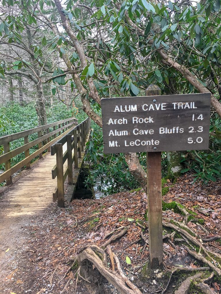
Alum Cave Trail to Arch Rock
There are a few highlights along the Alum Cave Trail to the summit of Mount LeConte: Arch Rock, Alum Cave Bluffs, and Mt. LeConte. Arch Rock is just 1.4 miles from the trailhead.
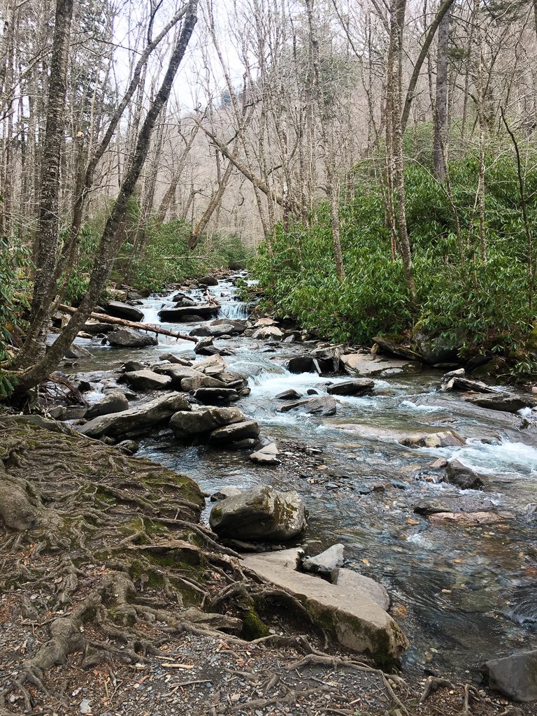
The trail starts off pretty mellow and follows alongside Alum Cave Creek.
If you hike the trail during early summer, you’ll get to see beautiful blooms of rosebay rhododendron. The trail gradually inclines before reaching the final log bridge crossing just before Arch Rock.
Arch Rock to Alum Cave Bluffs
Arch rock is a natural arch with stone-carved steps that you’ll have to climb up as you follow the trail through the cave. Don’t mistake Arch Rock for Alum Cave Bluffs. You are well on your way but you’ll continue ascending the Alum Cave Bluffs trail for another mile.


Alum Cave Bluffs
At mile 2.3, you’ll reach Alum Cave Bluffs. Depending on the perspective, Alum Cave may look like a cave but it’s actually a concave bluff that is around 80 feet high and 500 feet long.
During the winter you can find massive icicles hanging above. We hiked the trail in February and had to dodge water droplets and large icicles falling from above, so be careful while you walk underneath it.

Alum Cave Bluffs to Mt. LeConte
You are already halfway to the summit of Mt. LeConte! The trail continues to ascend towards the summit of 6,593 ft. There are plenty of switchbacks along the way as well as metal cables to hold on to as you hike on narrow ledges.
In February, we found a lot of ice built up on the ledges and the metal cables completely frozen over. This made it difficult to cross some areas. It would be useful to have gloves and ice grips on your shoes in these areas.


After passing one of the last ledges, the trail starts to level out as you wander through the spruce-fir forest. The trail runs into the Rainbow Falls Trail and you’ll find the LeConte Lodge nearby.

Mt. LeConte Lodge
It was supposed to rain on us, but it started to snow instead! The snow was heavy and there was A LOT of it.
If you veer off to the left, you’ll find LeConte Lodge. LeConte Lodge is the highest guest lodge in the eastern United States and sits just below the summit of Mt. LeConte. The lodge is only accessibly by hiking to it. During the summer, you can even stay the night at the lodge.

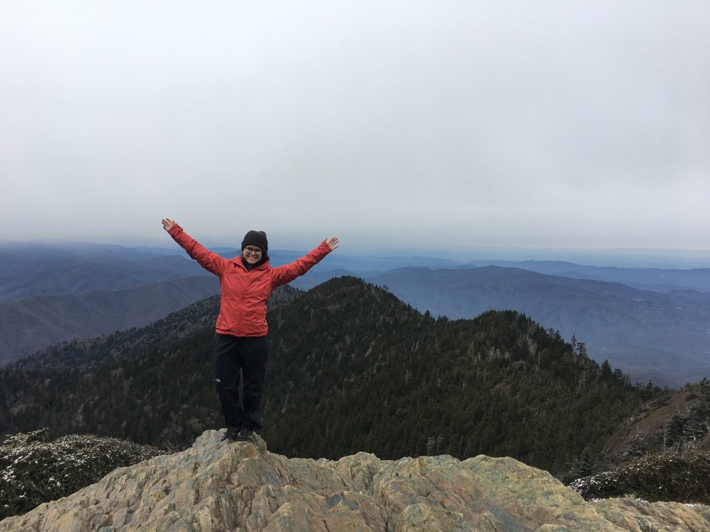
The True Summit and Panoramic Viewpoint
The trail doesn’t end at LeConte Lodge. In order to reach the reach summit, you’ll continue along the trail until you find a large cairn, or pile of rocks, that marks the true summit of Mt. LeConte.
If you want to get an amazing panoramic view of the Smoky Mountains, you can take the Cliff Tops route on the right side of the trail. It’s another 0.2 mile climb to the top and it is absolutely worth it.
By the time we reached the top of Cliff Tops, the snow stopped and the sky cleared up just long enough to get these incredible views! AMAZING!

The hike to the summit of Mt. LeConte takes about 5 hours roundtrip. Reaching the summit was absolutely magical. Be careful on your way down so you’re not slipping of any ledges!
Happy hiking!
Pin For Later

Do you have any questions about hiking Mount LeConte? Let me know in the comments.

Hi there! Dogs have never been allowed on this trail. There are only two trails in Great Smoky Mt NPS that allow pets (on leash only). Both of those trails are on the edges of the park near non park lands. Please check with the park service before visiting with a pet to these fragile environments and posting about it ❤️
Hi Laura! Thank you for sharing this information. There were no signs about dogs at the trailhead we took and I don’t remember reading about it either. I will update this post to reflect that information. Thank you for helping to protect our environment. – Andrea
Le Conte is actually not the highest point in TN. That would be Clingman’s Dome, which is a little higher.
Oh, I must’ve mixed it up! Thank you for letting me know.