This shale-covered beach hike in Seward, Alaska leads to Caines Head public use cabins and an abandoned World War II fort.
The only catch? Hiking to Caines Head Callisto Canyon Cabin in Seward is only accessible during low tide.
If you’re not interested in hiking, you can also access the cabin by kayak or a Seward water taxi.
Caines Head State Recreation Area is the perfect combination of nature. You’ll cut through the forest and wind up hiking along the beach. This trail also offers views of Resurrection Bay and Thumb Cove State Marine Park.
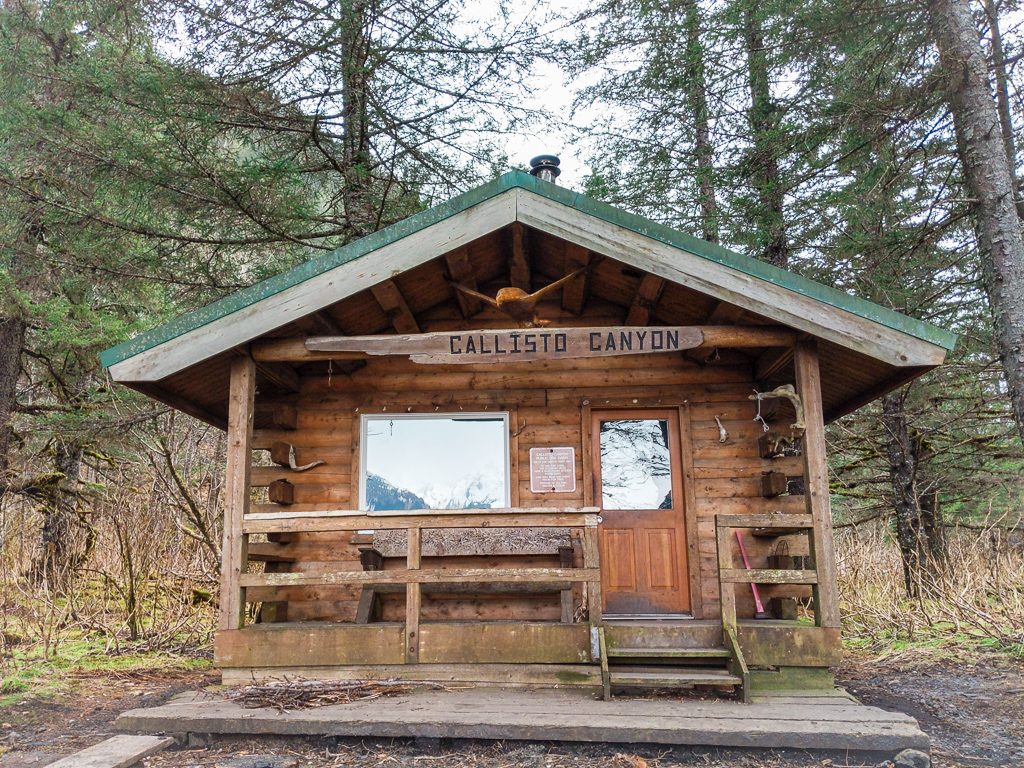
In this post, I’m sharing how to hike to Callisto Canyon Cabin in Seward, Alaska.
Callisto Canyon Cabin Trail Summary
Traditional Land: Alutiiq (Visit Native-Land.ca to identify whose land you live, work, and play on.)
Distance: 8 miles roundtrip
Time: 4 hours
Elevation Gain: 200 feet
Difficulty: Moderate
Dogs: Yes
How to Get to Callisto Canyon Cabin Trailhead
Once you reach Seward, continue along the highway through the end of town before taking a right on Lowell Point Road. Take a left on Border Ave. and take a right on Pinnacle View Rd. Tonsina Point State Recreation Site will be on your right.
The trail to Caines Head’s Callisto Canyon Cabin starts at the upper parking lot at Tonsina Point State Recreation Site. Parking costs $5 and the start of the trail begins to the left of the public bathrooms.
How to Time Your Trip Around Seward Tides
In order to hike to Caines Head, you need to know how to time your trip around Seward tides. The key is to start your hike before low tide.
Heading out to Caines Head, you should leave 2 hours before low tide. On the way back from Callisto Canyon Cabin to the trailhead, you should leave 1.5 hours before low tide.
If you leave earlier, you may get stuck near the rocky outcrops. When the tide is too high, some areas may be too dangerous to pass. The rocks are slippery.
Trust me. Learn from our mistake. We left too early on the way back to the trailhead and it was super sketchy crossing over one of the rocky sections. You can see more in my YouTube video (video opens in new tab).
How to Read the Seward Tides
Adjust the dates to when you’re planning on hiking. The data displayed will show the time of the tides, if it’s high (H) or low (L) tide, and the predicted tide in feet. This is really important because you can only hike to Caines Head when the tide is less than 3 feet.
What to Pack
- Rain jacket
- Rain pants
- Trekking poles
- Cooking equipment
- Water
- Snacks
Hike to Caines Head Callisto Canyon Cabin
Lowell Point to Tonsina Point
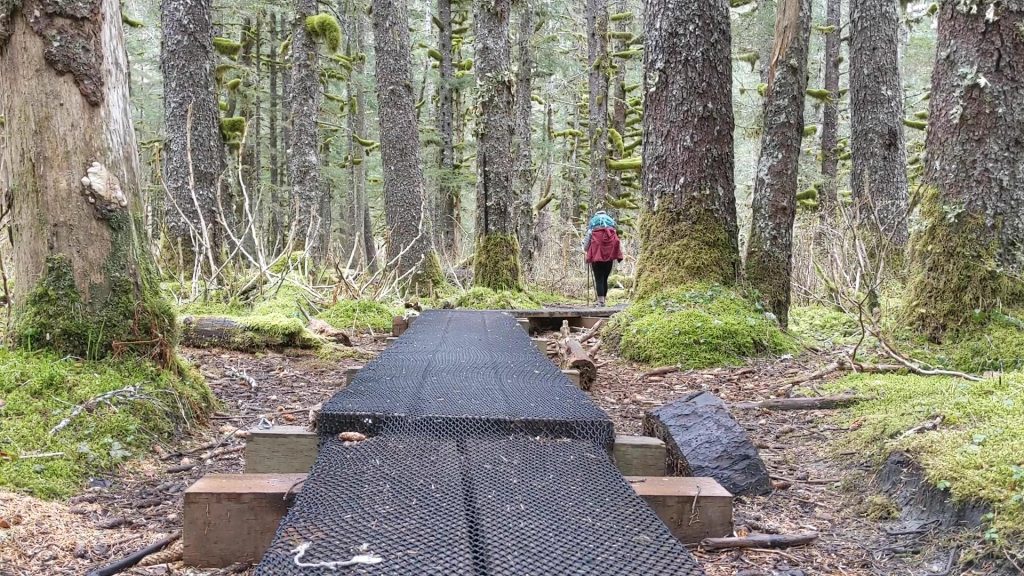
The trail from Lowell Point to Tonsina Point is 1.7 miles. The trail follows an old wagon trail through the forest. This part of the trail is uphill. You will gradually ascend 200 feet before descending on switchbacks as you get closer to the beach.
After the descent, you’ll cross over a creek on a large wooden bridge, giving you the first views of Resurrection Bay. The trail continues through the mossy forest. You will walk over wooden boards and cross more bridges until you finally make it to Tonsina Point.
Tonsina Point to Callisto Canyon Cabin
Once you reach Tonsina Point, you will walk another 2.3 miles to reach Callisto Canyon Cabin. The trail is flat but covered in a lot of rocks. You’ll walk the beach and pass Tonsina Cabin, which is marked by a buoy and can’t be missed.
Watching the Tide
There are two rocky outcrops that can only be safely passed when the tide is low. In order to pass these safely, you have to make sure you start your hike two hours prior to low tide. Don’t risk the chance of getting stuck in the middle of the beach.

Beyond Callisto Canyon Cabin
There’s a lot more to explore beyond Callisto Canyon Cabin. Spend a day hiking to North Beach, South Beach, or the remains of Fort McGilvray. Or check out Derby Cove Cabin, which is another public use cabin in Caines Head.
Watch YouTube Video: Hiking Caines Head to Callisto Canyon Cabin
Pin For Later

Do you have any questions on hiking to Callisto Canyon Cabin in Caines Head State Recreation Area in Seward? Let me know in the comments.

Tide has to be less than 3’. For my dates the low tides range between 2.19 and -0.30, so both of those are less than 3’ yes? Have wanted to do this hike for nearly a decade. It’s time to check the box.
Hi Amy! Yes, the tide should ideally be less than 3 feet high. So it looks like the LOW tides you mentioned 2.19 and -0.30 will be easy to pass! Make sure to double-check the exact times of low tide for the days you plan on hiking. It’s a really cool area to explore and a great hike to finally check off!