When most people think of the best hikes in Whittier, Portage Pass usually comes to mind, but you’ll soon find out that there are a lot more hiking options in this small town tucked away in Prince William Sound.
From glaciers to beautiful coves, the hiking trails in Whittier offer a lot of variety.
In this post, I’m going to share the 5 best hikes in Whittier, Alaska, and directions on how to get to each one.
How to get to Whittier from Anchorage
Whittier is located 60 miles south of Anchorage. It usually takes 1 hour and 20 minutes to drive there. It may take longer if you don’t pay attention to the Whittier Tunnel Schedule.
Follow the Seward Highway south and exit left on Portage Glacier Road. Follow the road through the tunnel to Whittier.
5 Best Hikes in Whittier, Alaska
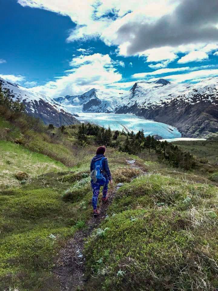
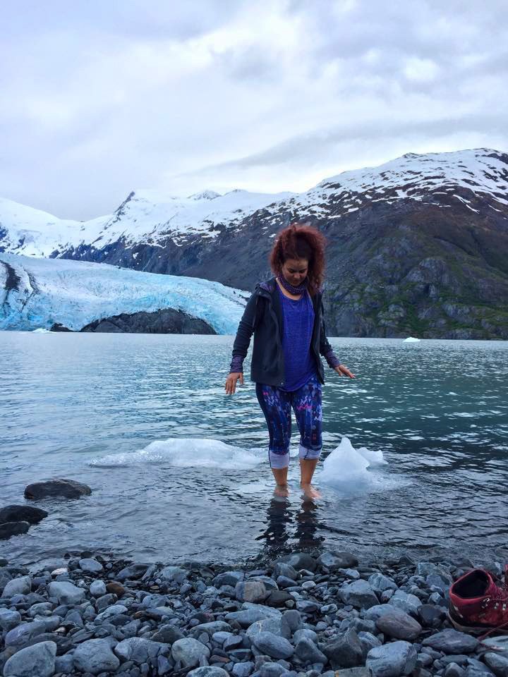
1. Portage Pass Trail
Distance: 4 miles roundtrip
Time: 2 hours
Elevation Gain: 750 feet
Difficulty: Moderate
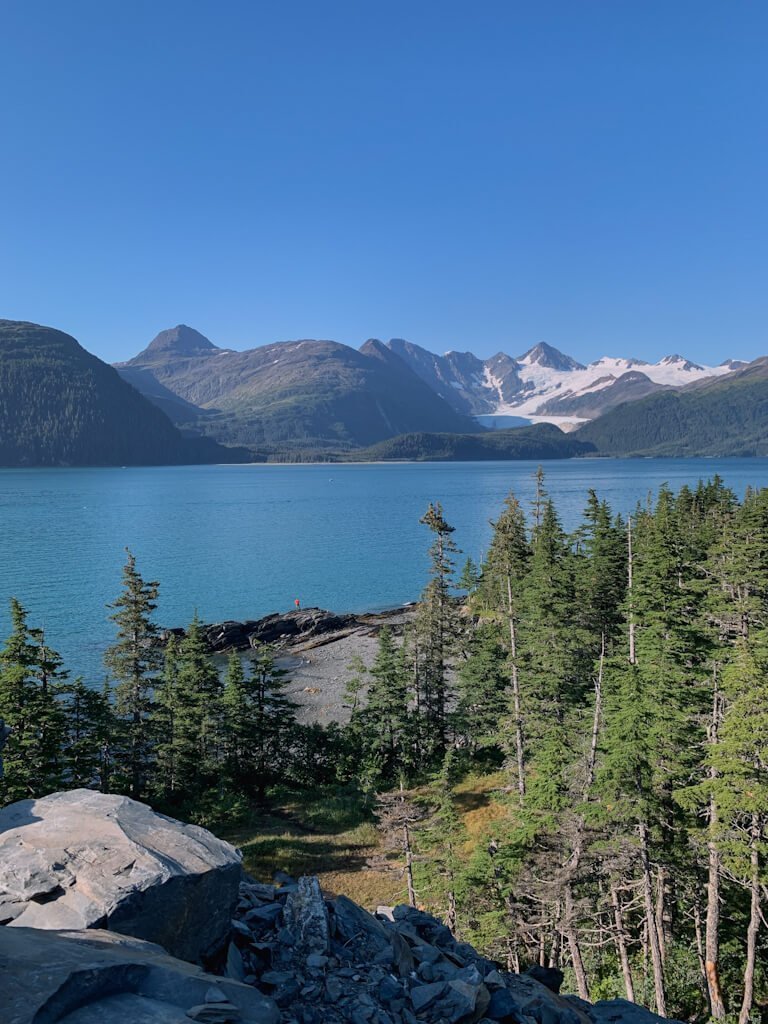
This 4-mile out-and-back trail climbs to the top of Portage Pass and descends to Portage Lake, rewarding you with views of Portage Glacier.
How to get to Portage Pass Trail from Anchorage:
Take the Seward Highway South for 48 miles. Turn left towards Portage at Portage Glacier Road. Follow Portage Glacier Road through the tunnel to Whittier. Turn right at W Camp Road. There will be parking at the end of the road.
2. Whittier Creek Falls
Distance: 150 feet
Time: 30 minutes
Elevation Gain: 0 feet
Difficulty: Very Easy
You can hear the water rushing from the Whittier Creek waterfall as you walk around Whittier. You can get closer to the waterfall by exploring Whittier Creek.
How to get to Whittier Creek Falls from Anchorage:
Take the Seward Highway South for 48 miles. Turn left towards Portage at Portage Glacier Road. Follow Portage Glacier Road through the tunnel to Whittier. Turn right at W Camp Road. Turn right onto Whittier Street. Turn right onto Glacier Avenue and park near the end of the road.
Read more: 5 Glacier Hikes Near Anchorage
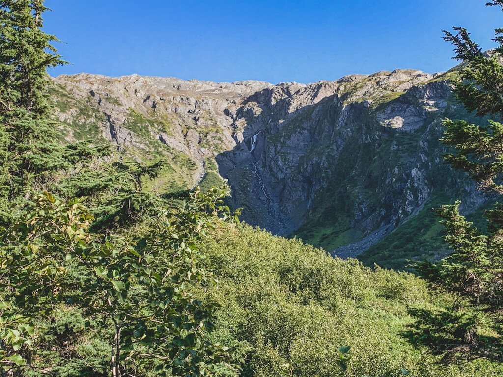
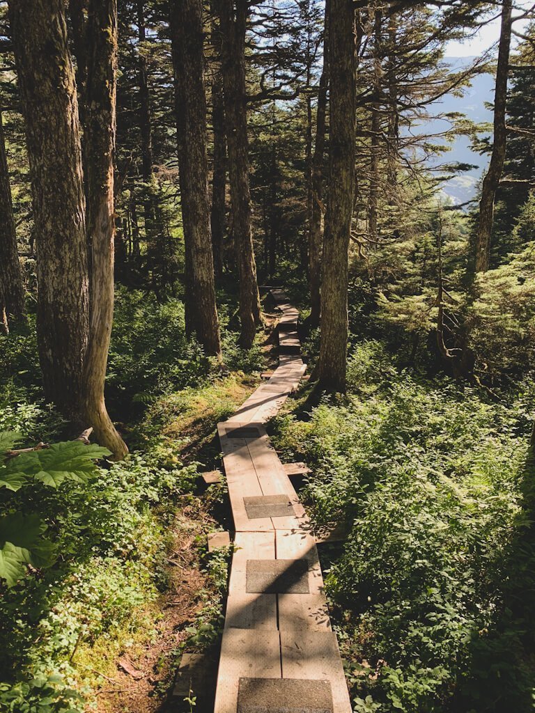
3. Horsetail Falls Trail
Distance: 2 miles roundtrip
Time: 1.5 hours
Elevation Gain: 400 feet
Difficulty: Easy
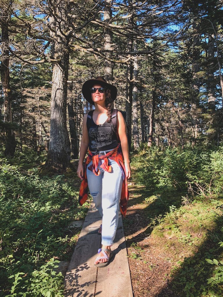
The Horsetail Falls Trail follows a wooden boardwalk through spruce and alder forest and leads you to a waterfall. You will find blueberries and salmonberries are abundant here around August.
How to get to Horsetail Falls Trail from Anchorage:
Take the Seward Highway South for 48 miles. Turn left towards Portage at Portage Glacier Road. Follow Portage Glacier Road through the tunnel to Whittier. Turn right at W Camp Road. Turn right onto Whittier Street and continue onto Blackstone Road. Turn right onto Shotgun Cove Road. Turn right onto Reservoir Road. Park at the end of the road near the metal gate.
4. Blackstone Bay Vista
Distance: 6.4 miles roundtrip
Time: 5 hours
Elevation Gain: 2,760 feet
Difficulty: Moderate
This trail continues from the Horsetail Falls Trail towards 360-degree views of the surrounding fjords, including Blackstone Bay. The trail to Blackstone Bay Vista does require some route-finding and scrambling once you’re above the tree-line, but you may find some cairns to help guide you. Be bear aware.
How to get to Blackstone Bay Vista Trail from Anchorage:
Take the Seward Highway South for 48 miles. Turn left towards Portage at Portage Glacier Road. Follow Portage Glacier Road through the tunnel to Whittier. Turn right at W Camp Road. Turn right onto Whittier Street and continue onto Blackstone Road. Turn right onto Shotgun Cove Road. Turn right onto Reservoir Road. Park at the end of the road near the metal gate.
Read more: What to wear hiking in Alaska
5. Emerald Cove Trail/Shotgun Cove Trail
Distance: 6 miles roundtrip
Time: 3 hours
Elevation Gain: 100 feet
Difficulty: Easy
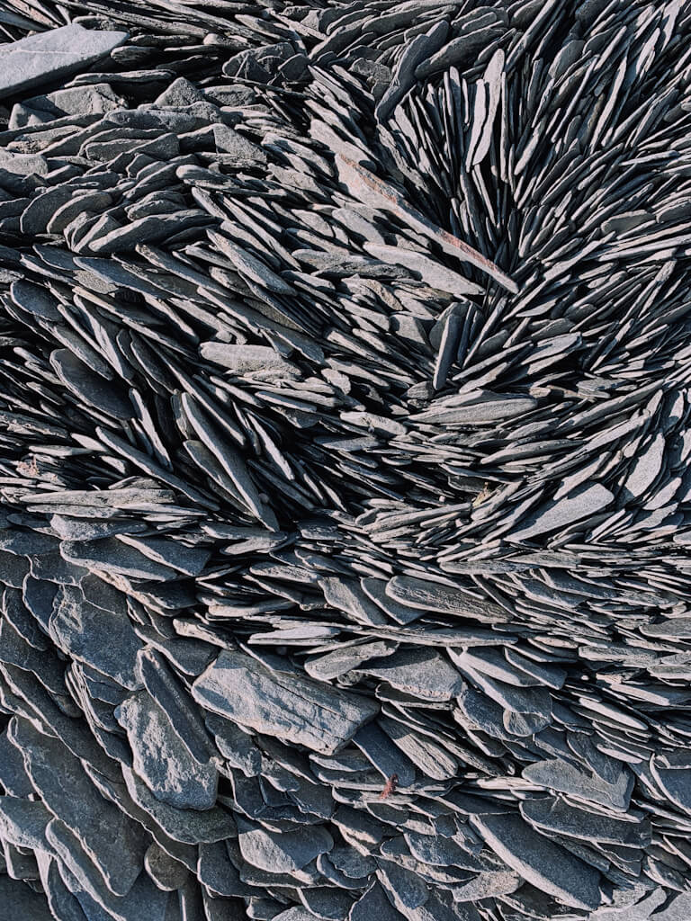
The Emerald Cove Trail/Shotgun Cove Trail hugs the coastline and leads to a secluded, rocky beach, which can be found about a mile down stone steps. Since you have to forge two creeks and the trail tends to be muddy, don’t forget your XTRATUF boots. Also, keep an eye out for berries and bears.
How to get to Emerald Cove Trail/Shotgun Cove Trail from Anchorage:
Take the Seward Highway South for 48 miles. Turn left towards Portage at Portage Glacier Road. Follow Portage Glacier Road through the tunnel to Whittier. Turn right at W Camp Road. Turn right onto Whittier Street and continue onto Blackstone Road. Turn right onto Shotgun Cove Road and follow until the end of the road.
Pin This Post For Later
Do you have any questions about these awesome Whittier hikes? Leave them in the comments.