Yr Wyddfa (Snowdon) is the tallest mountain in Wales at 1,085 meters (3,560 feet). It’s located in Eryri (Snowdonia) National Park and ranks as one of the busiest hikes in the entire country (over 600,000 people hike it annually).
There are six common walking paths to reach the summit of Yr Wyddfa. Each path varies in length and difficulty, but all are considered to be hard hikes.
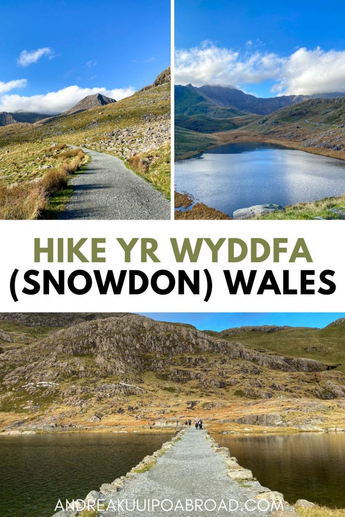
For our first attempt to summit Snowdon, we decided to hike The Miner’s Track. This route is 8 miles (13 km) roundtrip and starts from the Pen y Pass car park. Along this route, you’ll get to see three beautiful mountain lakes.
On the way down, we took the PYG Track to hike a circular loop.
In this post, I’m going to share how to hike Yr Wyddfa via The Miner’s Track in North Wales.
AndreaKuuipoAbroad.com contains affiliate links to various products, which means I may earn a small commission for qualifying purchases at no extra cost to you. Thank you for supporting my website. Read more about my Affiliate Disclosure.
Hike Yr Wyddfa in Eryri National Park
Distance: 8 miles (13 km) roundtrip
Time: 6 hours
Elevation Gain: 2372 feet (723 m)
Difficulty: Difficult
Quick Tips
- Pre-book parking or plan to arrive early
- Hike off season to avoid large crowds
- Check the weather before you go
- Wear proper shoes and clothing
- Know the route or bring a map
- Download the Llwybrau Yr Wyddfa / Snowdon Walks app
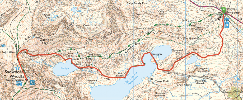
Snowdon via The Miner’s Track Hiking Map
Take a look at The Miner’s Track Ordinance Survey GPS route to help you plan your Yr Wyddfa hike.
Official Maps
- Ordnance Survey: OL17 / 114
- Harvey Maps: Snowdonia North
How to Check Snowdon Current Conditions
Before heading off to hike Yr Wyddfa (Snowdon), check the current parking situation on the Eryri National Park website and the current conditions report here.
How to Get to The Miner’s Track Trailhead
The Miner’s Track starts from the Pen y Pass car park in Snowdonia National Park. Since this is a popular hike, it can be difficult to find a parking spot. We arrived around 10 a.m. and had to park 2 miles down the road from the trailhead. I recommend arriving by 7 a.m. during the peak season and 8 a.m. off-season.
Pen y Pass car park is pre-book only. You can book online using the JustPark website. If you can’t find a parking spot then you can park elsewhere and take a taxi or use the Snowdon Sherpa bus.
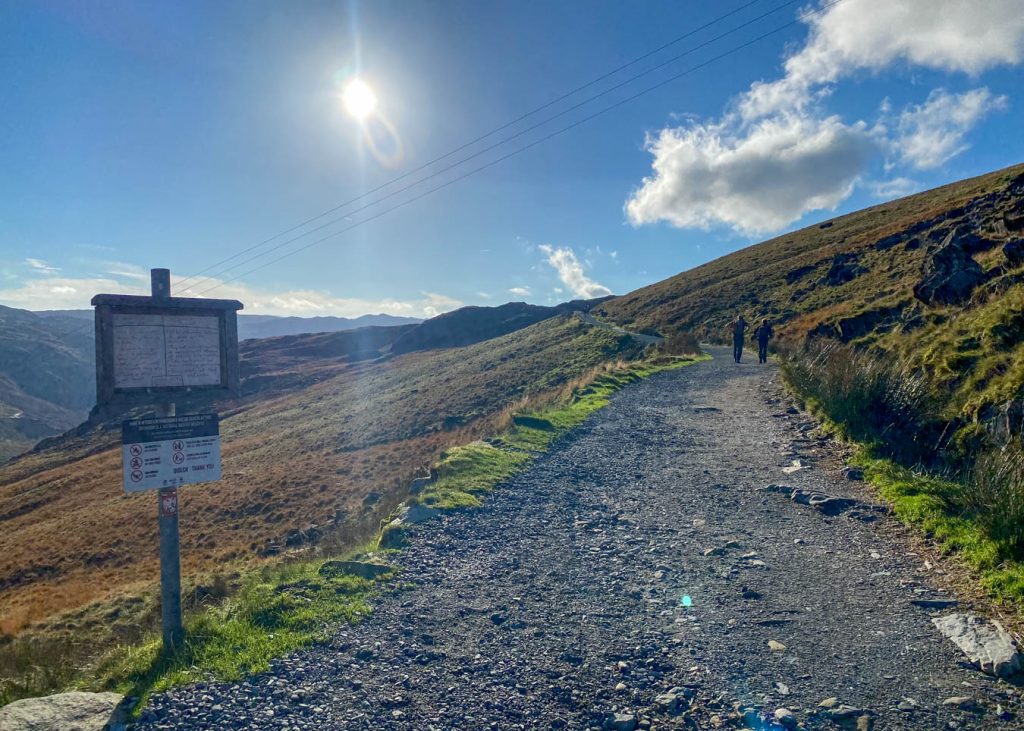
The Miner’s Track Trailhead
Before making your way to the trailhead, make sure to use the public toilets because you won’t find another one until you reach the summit. Pen y Pass also has a lovely cafe so you can grab coffee or chips before or after your hike.
The Miner’s Track starts from the back left corner of the Pen y Pass car park. You will pass through a large metal gate that is way-marked with a Miners Track stone.
Llyn Teyrn
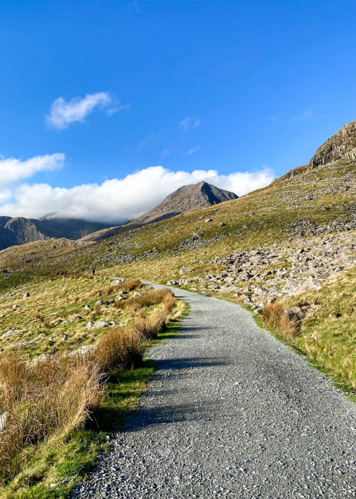
The track follows a wide gravel path. There is very little elevation gain in the first 3.5 km along this route. As you continue hiking, you will see Crib Goch and Yr Wyddfa in the distance. You will also come across your first mountain lake, Llyn Teyrn.
You may also notice a pipeline stretching down the valley on your left. This pipeline supplies water from Llyn Llydaw to the Cwm Dyli hydro-electric power station at Nant Gwynant. It is the oldest power station in Britain!
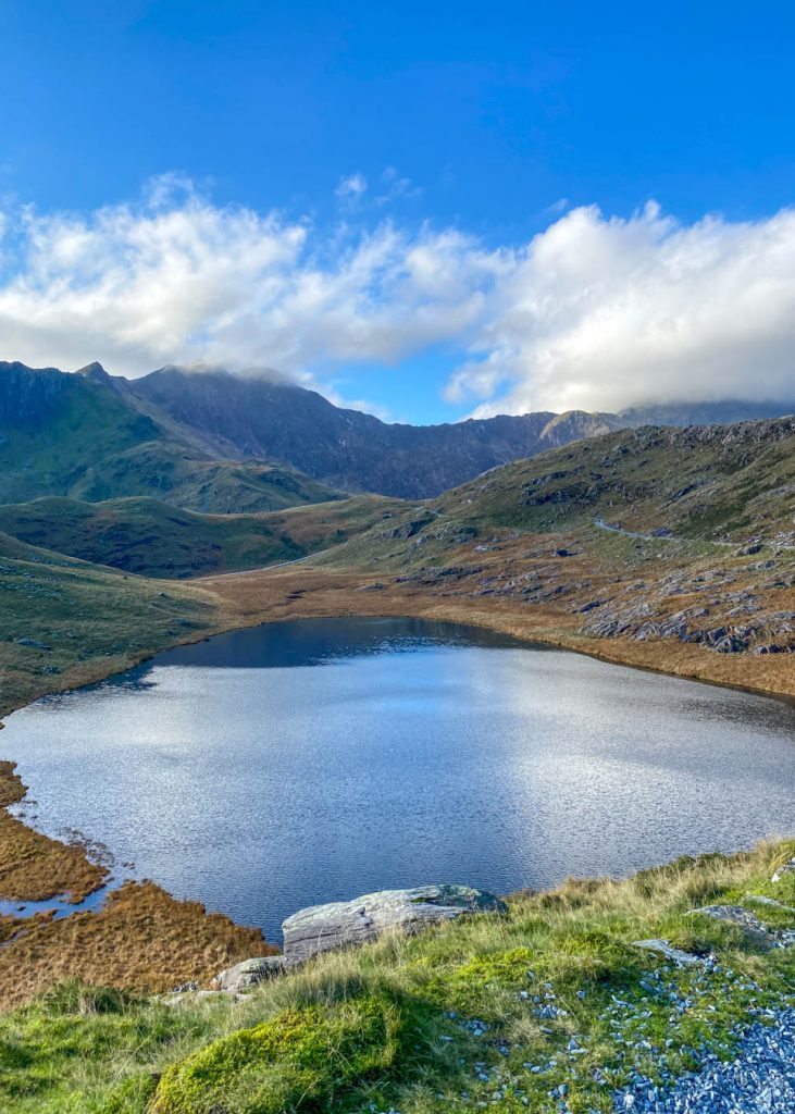
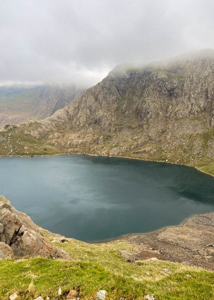
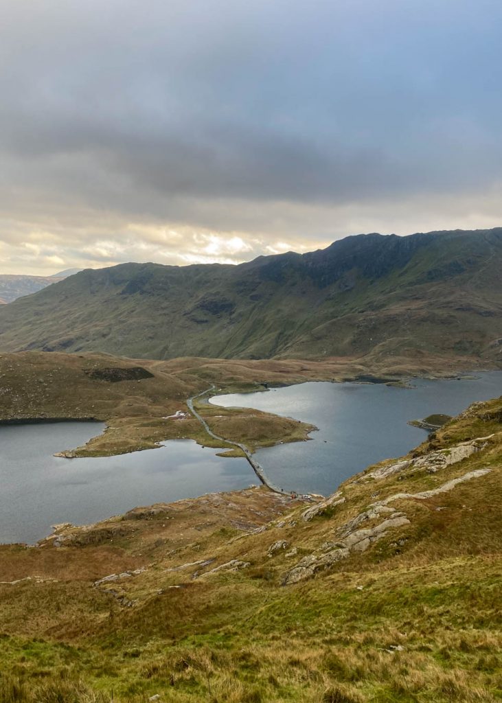
Llyn Llydaw
After hiking a bit over 2 km, you’ll make it to Llyn Llydaw, which is a huge reservoir. One of the most beautiful areas of the hike was crossing over the lake on the causeway. It was so picturesque.
Fun Fact: Before the causeway was built in 1853, miners used a raft to carry horses and wagons full of copper across the lake.
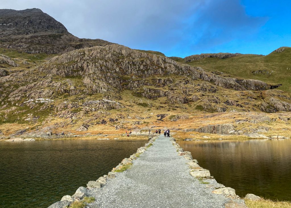
After you make your way across, the path continues to follow the shoreline of Llyn Llydaw. If you look around, you will see remains of the Britannia Copper Mine, which include the crushing mill and some of the miner’s barracks.
Once you make your way around the corner, The Miner’s Track changes into a cobblestone path and you’ll start to notice an elevation gain.
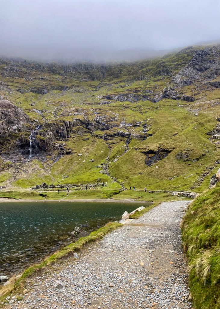
Glaslyn
As we continued to hike along The Miner’s Track towards Glaslyn, the weather started to change. The clouds rolled in and the temperatures dropped.
Usually when your reach Glaslyn, you will be rewarded with some amazing views of Yr Wyddfa. Unfortunately, this wasn’t the case for us. We decided to stop here and eat some snacks before the climb up the steepest section of the path.
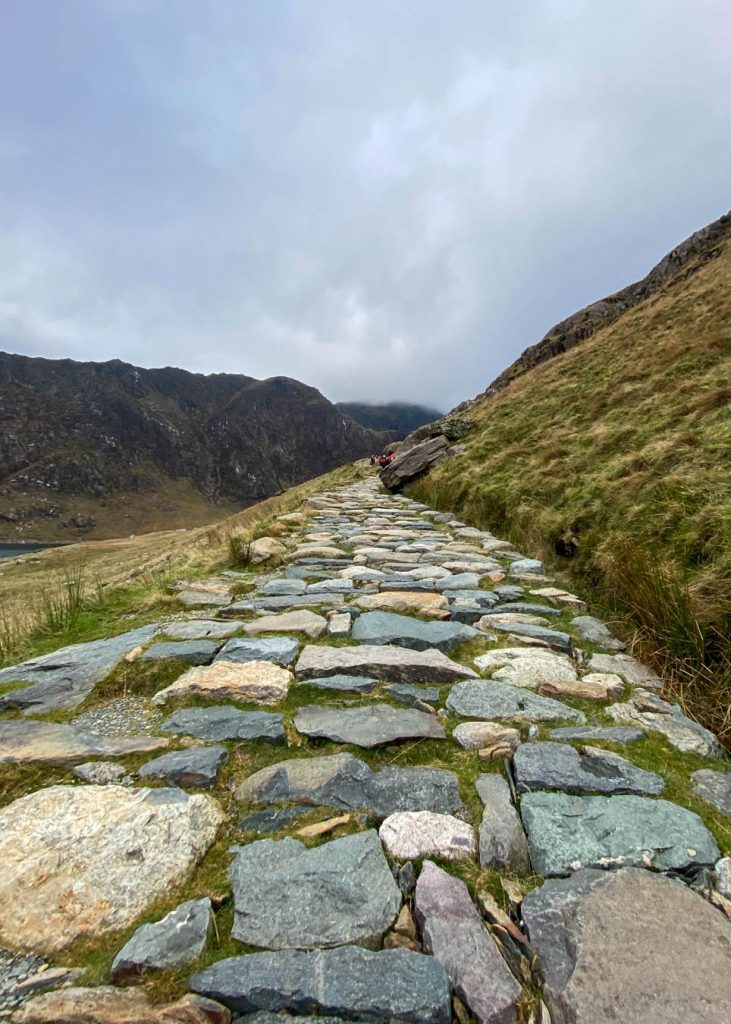
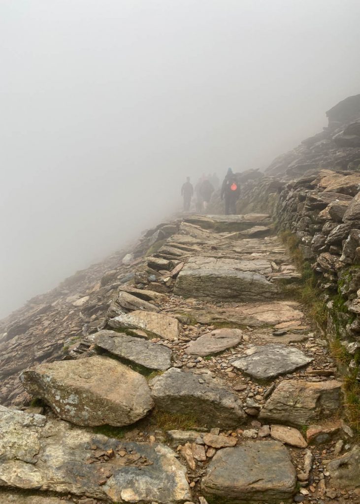
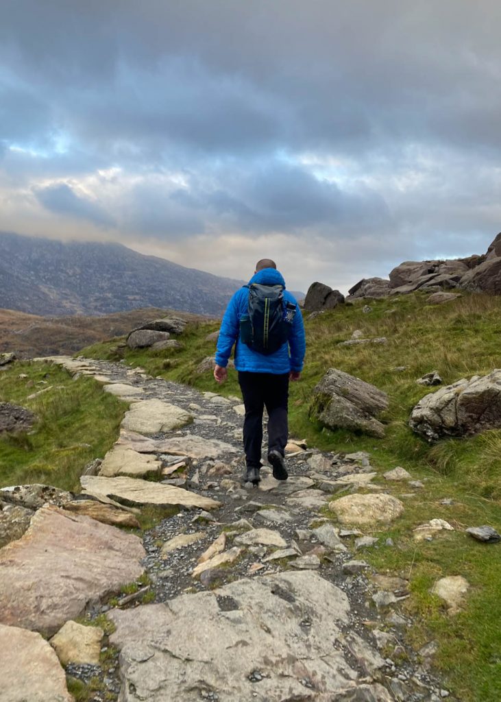
At the edge of the lake, you’ll start to climb the stone path. The path is fairly easy to follow but it’s just as easy to lose the path if you aren’t paying attention or there isn’t anyone to follow.
This part of the route can be very slippery, especially when covered with ice and snow. It’s best to avoid hiking in these conditions unless you are an experienced hiker and have the proper equipment.
The path soon merges with the PYG Track and this is where the trail gets busier. Remember this junction if you plan on taking The Miner’s Track on your way down.
Bwlch Glas
The path has a few switchbacks that you will follow until you reach the summit of Bwlch Glas. This is where the trail joins the Llanberis Path and the Ranger Path.
You will be able to see the Snowdon Railway tracks from here as they parallel the hiking path. For safety reasons, don’t walk along the tracks. The Snowdon Mountain Railway is an easy alternative to reaching the summit of Yr Wyddfa if you’re unable to hike. The train has been taking visitors to the summit since 1896!
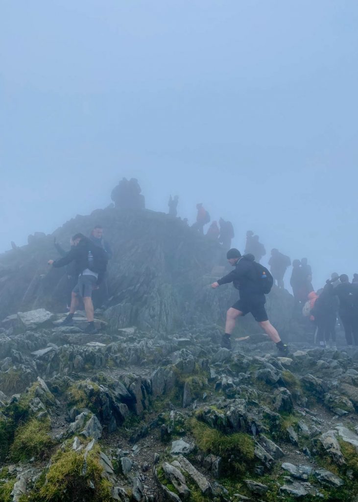
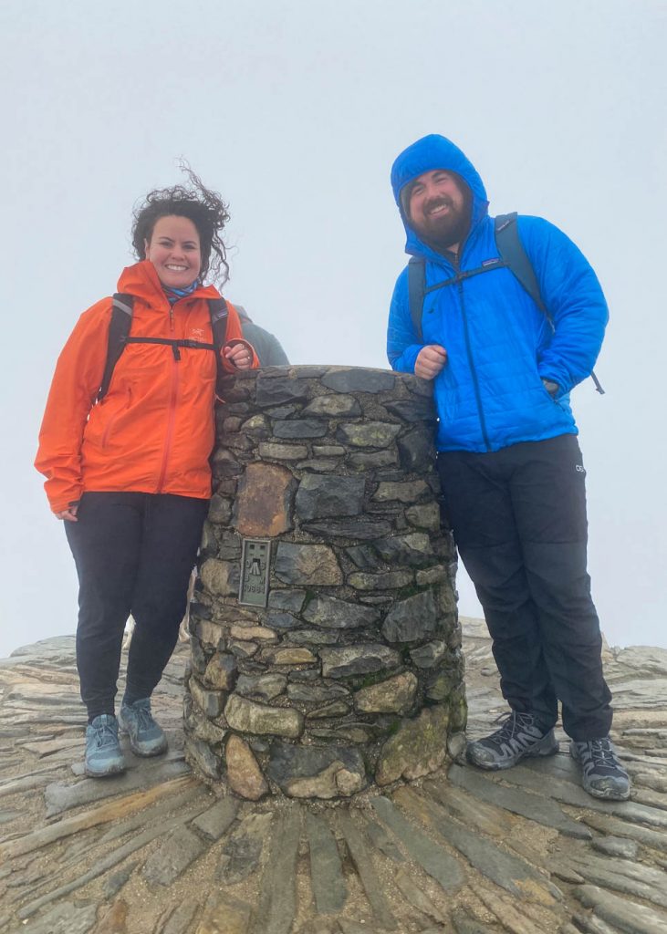
Yr Wyddfa (Snowdon) Summit
It’s time for the final push to the summit. Follow the path and steps up for just a couple hundred meters until you reach the Yr Wyddfa summit and trig point!
The summit is usually busy and you may have to wait in a queue if you want to take a photo. The weather was still socked in when we made it to the top so we didn’t have any views of the surrounding peaks.
Hafod Eryri Summit Station
At the summit, you’ll find the Snowdon Summit Station (Hafod Eryri). This is actually a café that sells hot and cold drinks and snacks. There are also toilets here if you need to use one. Keep in mind that the café and toilets aren’t always open.
Descending Yr Wyddfa via PYG Track
As you descend Snowdon, you can choose to hike down a different path. We chose to take the PYG Track that connects to The Miner’s Track in order to hike a circular loop.
From the Bwlch Glas way-marker, we hiked down and then continued onto the connecting PYG Track. The path was mostly level as it followed a high route above the lakes, which made for some amazing photo ops.
Eventually, the track passes through a stile before dropping down the final descent made of stone steps. After what feels like a lot of steps, you’ll make it right back to the Pen y Pass car park.
It took us just under 6 hours to complete the circular route up Yr Wyddfa via The Miner’s Track and down the PYG Track.
Since we parked at one of the lower car parks, we hiked an additional 4 miles roundtrip and gained 600 feet of elevation. I tracked a total of 11.87 miles and 3,438 feet of elevation.
Next time, I would like to take the path over Crib Goch and hopefully get some nicer weather for clear views!
Other Snowdon Walking Paths
Want to hike a different route to the summit of Yr Wyddfa? Here are the other recommended hiking paths.
- The Llanberis Path (9 miles/14.5 km)
- The PYG Track (7 miles/11 km)
- The Rhyd Ddu Path (8.5 miles/12km)
- The Watkin Path (8 miles/13km)
- Snowdon Ranger Path (8 miles/13km)
Happy hiking!
Read Next
7 Day Scotland Highlands Road Trip
Pin For Later
Do you have any questions about hiking Snowdon in Wales? Let me know in the comments.